
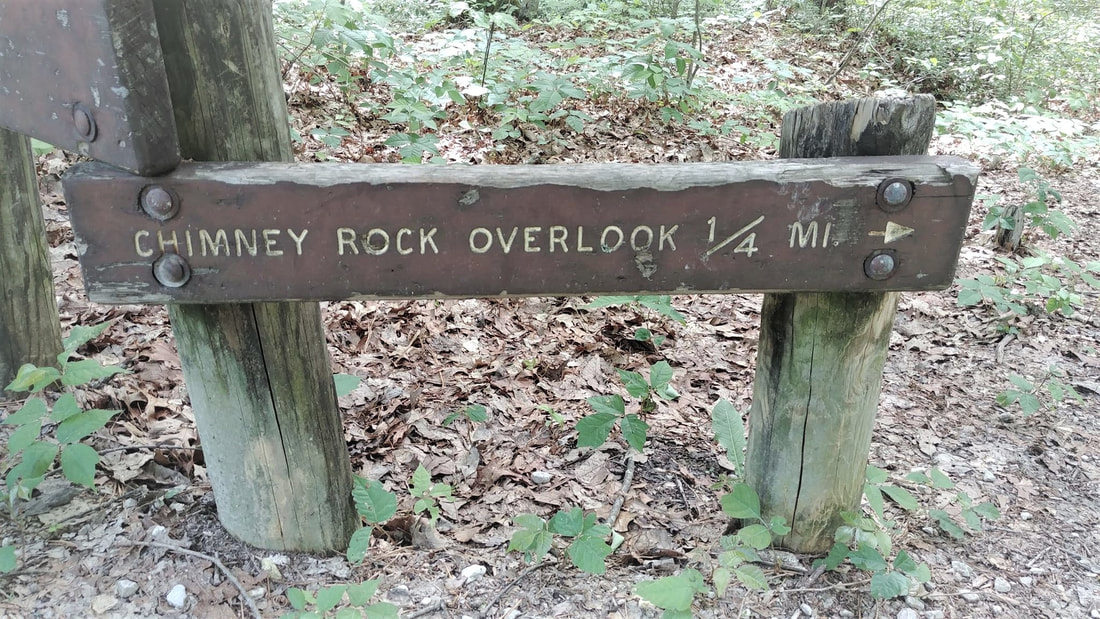
 I have not been on Chimney Top for years! It also has been awhile since I have taken our puppy on a hike. So I thought that this trail would be perfect because not only is it easy, it is also quick. Well, unless you decide to chill out at the overlook. Overlooks are like a campfire for me. I can just sit there and stare off into wonderland forever! 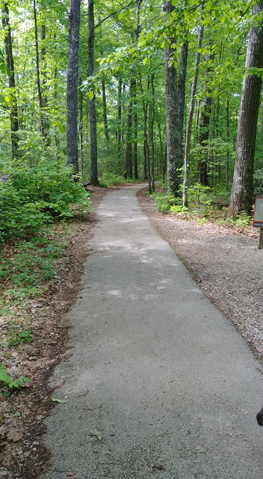 As we started on the trail I was so excited to see a paved path! I thought I could finally write that we have a trail that is wheelchair friendly! But it saddens me to say that it is not. The pavement turns rough and more like gravel and there are a couple hills that I think would be hard to push/pull someone. It is still a nice, easy, little hike, though. 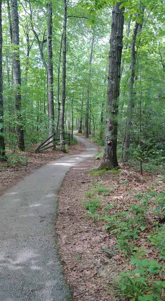 You only have to walk .25 miles to see one of the most beautiful overlooks in the Red River Gorge. As you can see from my pictures, the view is amazing! But even more important is that you can see those views at a comfortable distance from the edge. Please be safe y'all! Choose to get outdoors more and see this beautiful area we live in!
'Of all the paths you take in life, make sure a few of them are dirt.' - John Muir
1 Comment
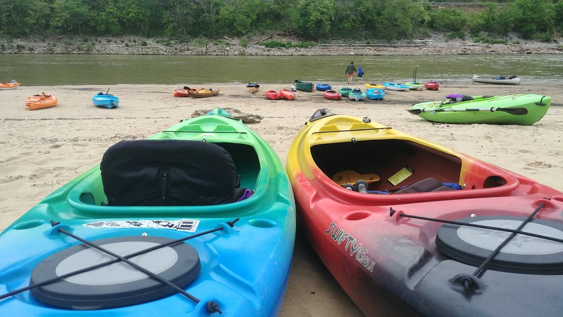 I am out of the woods and into the water in this post. It's kayak season! This last weekend I was able to participate in the 3rd Annual Bluegrass River Run at Fort Boonesborough State Park. If you enjoy kayaking or canoeing I highly encourage you to be part of this next year. Not only was the camaraderie with fellow participants great, I also got to spend time and have fun with one of my boys. I have been wanting to kayak on the Kentucky River for a few years now, but for one reason or another I just never got around to doing it. But if I'm honest, it's probably due to not knowing how quick or strong the river current was and how much debris I would have to paddle around. But I did it and am so glad I did! Not only was the current extremely slow, there was truly no debris. This makes for one nice float. And to top that off, the stretch between the park and Proud Mary's BBQ (take-out), is absolutely gorgeous. One of the first cool things I noticed was this huge hole in the side of the cliff. My son thinks it is a vent of some sort. I just think it is cool. 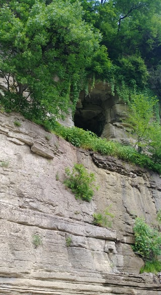 Another highlight was watching Blue Heron Cranes landing in the tip top of a tree! I have never seen that before! I always see them on a branch close to the water or them standing in the water. But as I floated closer I noticed that this tree was FULL of them. If you look closely at the photo below you can see black spots all over the top of the tree. Those are nests! So cool. 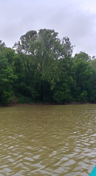 On this trip I learned that our state's namesake river is 260 miles long, about one-third of a mile wide and has an average depth of 20 feet. The river is broken up with a system of locks and dams every 15-20 miles. 100 miles of the river, including the stretch we floated, is within a canyon system called the Kentucky River Palisades. We live in such a beautiful part of the state y'all. Just as we round the bend to the take-out spot, there is a waterway off to the right which is Boone Creek. Of course we had to check it out. We were able to go in a little ways but had to turn around because of a fallen tree blocking any further access. The little bit we floated was really neat! And then, before we knew it, 2 hours had come and gone and we could start hearing the roar of I75. Up ahead we saw the bridge and new the float was coming to an end. Although my arms were pretty tired, I would have loved to keep going. But now I know that I love kayaking the Kentucky River. I hope that if you haven't and been thinking of doing it that you try this stretch. You will love it! Please wear you PFD at all times when floating. Take some water with you and maybe even a little snack. But most of all have fun and #optoutside! 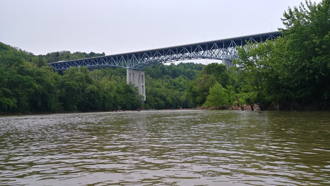 This trail is a connector to Auxier Ridge Trail #204. Making for a decision to do an out and back or a loop hike. In my opinion, which you will know if you read my last blog post, I highly recommend doing the loop because the views on Auxier Ridge are absolutely stunning. And if I got my calculations right, either way you will be hiking a total of 5 miles. I'm sorry the quality of the map isn't the greatest, but I wanted you to see exactly where this trail is. The parking area is decent size and also has a bathroom. 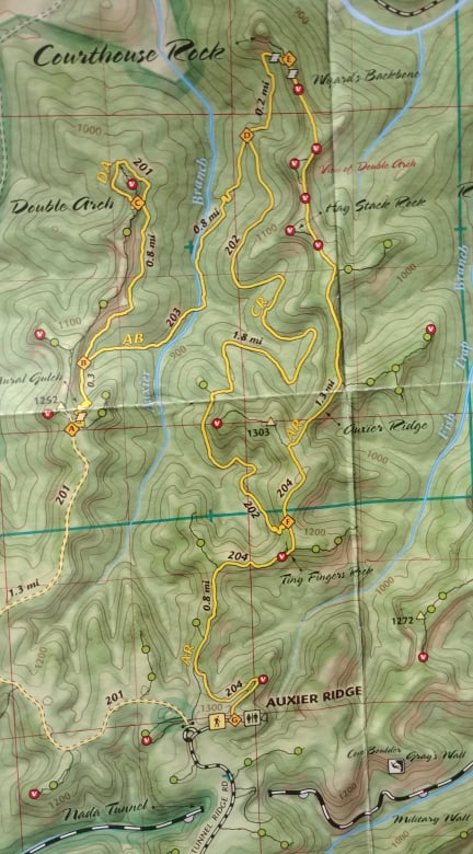 The reason I consider this trail difficult is mainly because of how you get onto the trail...from either end! If you hike the Auxier Ridge Trail to the end and get on it there, it is about a 3'-4' drop, instantly. I honestly questioned if it was the trail or not because it looked extremely difficult to get down. But, there was a couple who just came up it, with their trekking poles, mind you. So I had my typical thought, 'if they can do it, I can do it!' And I did! Then I remembered that I didn't get a picture of the sign. Argh! So instead of figuring out how in the world I was going to climb back up that mess, I just lifted my phone in the air and snapped this picture. It gives you an idea of how far down I am and how fast I got to that point. Maybe someday soon we will have steps put in there. 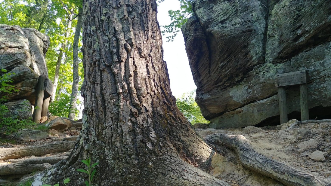 For about .2 miles you are actually still on the Auxier Ridge Trail. But soon you will come to a split that will take you on the Courthouse Trail #202 (on the left) or the Double Arch Trail #201 (on the right). I'm thinking my next hike will be the Double Arch Trail.  As I got onto the trail and all along the way I couldn't help but feel I was in fairyland. The pretty spring flowers are in bloom...beautiful ferns everywhere...and lizards. I can't tell you how many times I got a little spring in my step because of hearing the little guys rustling through the dry leaves or scurrying up a tree and even running across the path right in front of me. After I realize it's not a snake I go back to my normal pace...hee, hee! Because of the grass growing on the trail in spots, it makes me think it isn't a very popular trail. And if I am honest, it is going down as one of my least favorite. Not only is is a pretty hard trail because of the incline, but there is just nothing to look at. Nothing that catches your eye. And by now you know that I love seeing awesome things and taking pictures. But if you are wanting a peaceful, quiet walk in the woods and are up to a good workout, then this trail is for you. I did enjoy seeing all the wildflowers and the little grove of Bigleaf Magnolias towards the end of the trail. And you know? Just the fact that I was outside in the forest still makes it a great trail. 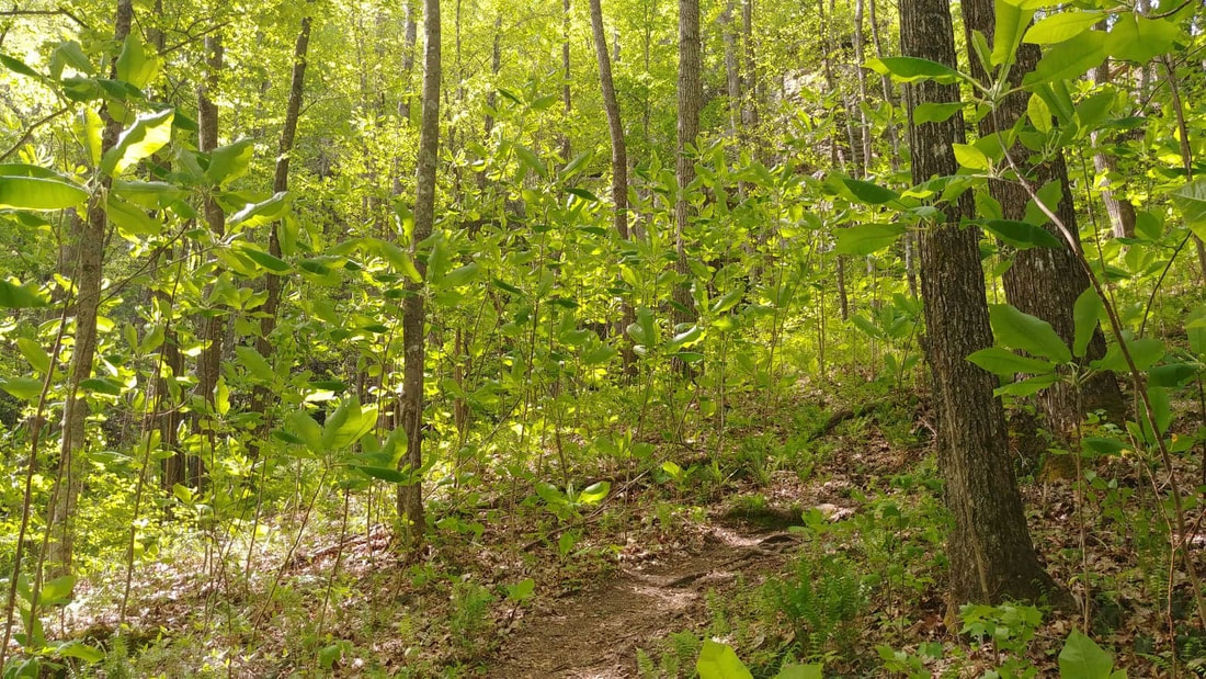 It is getting time to add a few things to your pack when you head out. Bug spray and more water. I can't stress enough about being safe out on these trails. Some things I always have in my backpack are: wallet, keys, phone, plenty of water, a couple Cliff Bars, chapstick, knife, whistle, maps and a small first aid kit. I'm sure there are more things I should pack but I feel I have a good start. I would love to hear what's in your backpack!
Also, whether you are hiking alone or with someone, always make sure someone knows what trail you are taking. This last week I even went into detail letting my husband know I was starting on Auxier Ridge and coming back on the Courthouse Trail. As much as you think you are invincible, accidents happen. And hopefully it never does, but better to be safe than sorry. I just want y'all to be safe! So hopefully you can get out sometime soon and enjoy our beautiful Red River Gorge or other trails around our area! Have fun and be safe! Don't forget that camera! And remember... 'Of all the paths you take in life, make sure a few of them are dirt.' - John Muir 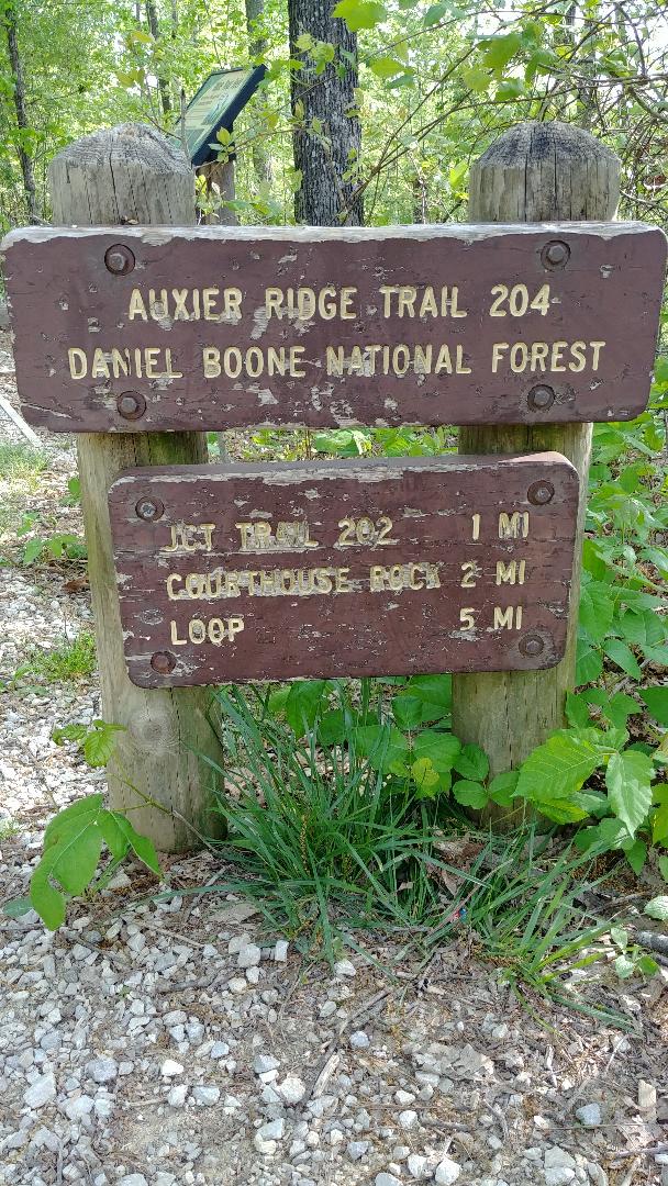 Happy first of May! Hiking weather is officially here and I couldn't be happier! And to make things even better, I hiked my absolute favorite trail yesterday...Auxier Ridge. When I hike, I love looking at the scenery and all that is around me. When I have to stop every few feet because of an awesome view or a really cool boulder that I just have to get a picture of, well, then I consider that a great hike. And this trail has that from the start! I took so many pictures, y'all!! 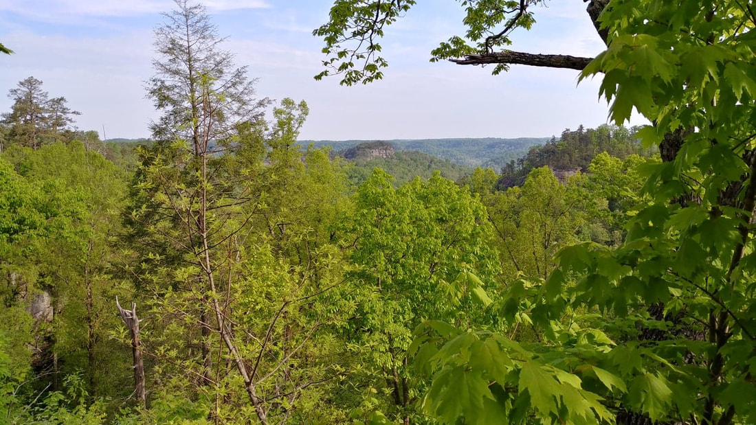 Raven's Rock in the distance 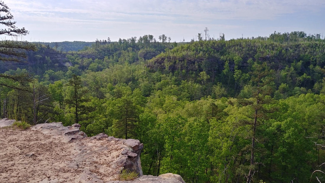 God's beautiful creation These are views within the first 100 feet of the trail-head! Remember, this is a ridge trail. So get ready for amazing views for the whole 2 miles out. 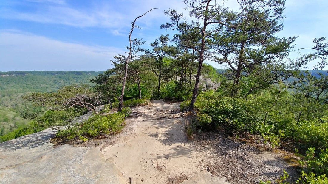 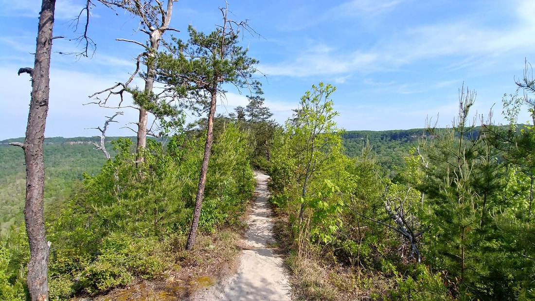 They definitely named this correct! You are up on top of the mountain, right on the ridge. But let's also get to the trail itself and let me tell you why I feel it is difficult. Besides the views, another reason I love this trail is that it isn't just walking on a dirt path. One minute it is level and smooth but then the next you are walking in a washout dodging little lizards. There are steps carved in rock....roots that have grown over the path to make the perfect steps....also, actual rock steps that I believe were just recently put in last year. Then there are the areas that you either slide down the sandstone rock or do deep knee bend steps. Currently, I do not hike with trekking poles. It's not that I don't want to, I just have never used them during my 40-some years of hiking. But let me tell you, after this hike, I am seriously considering them. Not only for the stability they provide while going up and down hills, over rocks and thru streams, but also to prevent my hands from swelling. What do you all think of them? I would love to hear your thoughts! Now, below is an excellent example of staying aware of the path you are on. For a split second, at this intersection I didn't know which way to go. As you can see, both paths are well worn. So my first instinct is to look for the diamond mark on the trees since I am in the Daniel Boone National Forest (other forests use different markings), and there it is staring right at me on the left. I believe the path to the right goes to some backpacking campsites. But by paying attention to the diamond I didn't waste time and have to backtrack or worse yet, get lost. 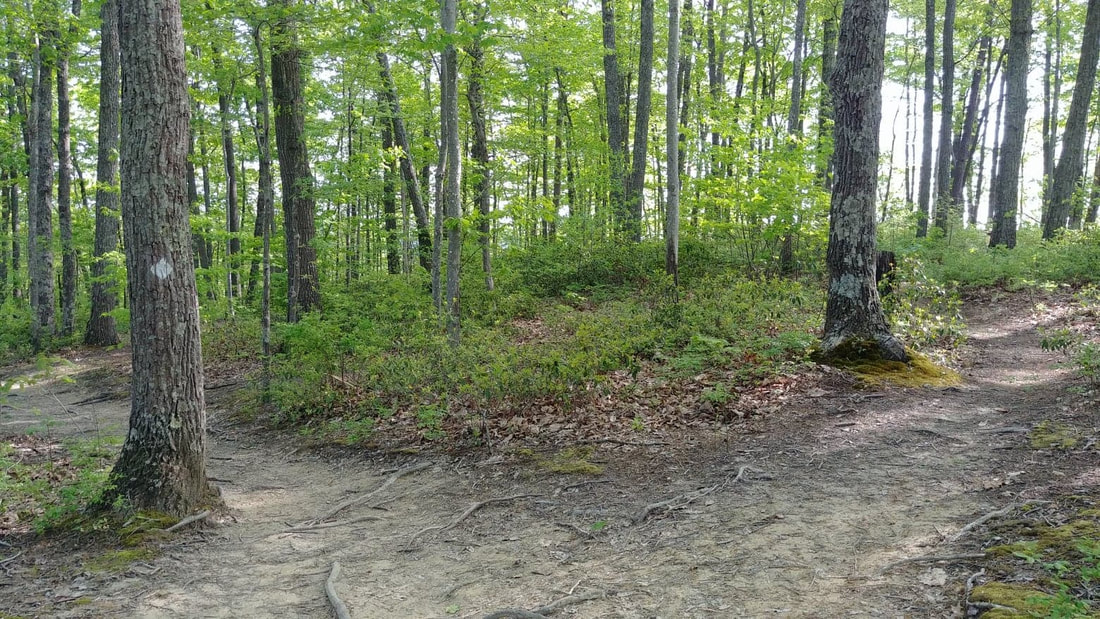 Now, on to some more amazing views! These next few pictures are from the ridge itself. Please be safe and stay away from the edges. Yes, we have a wonderful Search & Rescue crew that does a great job, but let's do our part and not keep them busy. Aren't these views just beautiful?! I could sit up here all day. So I did! Well, not all day. Long enough to drink some water and eat a protein bar while enjoying the hefty breeze, listening to the birds and watching to see if I could see anyone across the way, over at Double Arch. But the trail didn't end here! 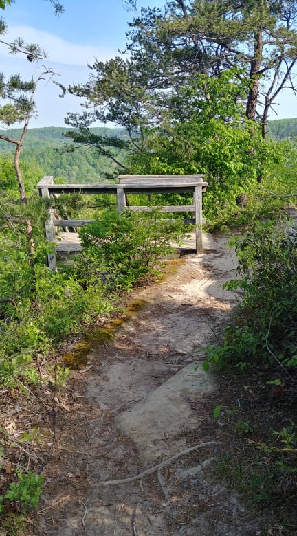 This is usually a site I don't love to see....stairs. But at least I am going down them! And the next few pics are views from those 113 steps! At this point the trail ends at Courthouse Rock. You can either go back or choose to make a turn there and either go on the Courthouse Trail or Double Arch Trail. I chose Courthouse Trail because I have never been on it. But I will share more on that in another post.
Well y'all, I sure hope you enjoyed the pictures and I hope you can get out soon to hike this path. Be safe! Grab that camera and go have fun! And remember... 'Of all the paths you take in life, make sure a few of them are dirt.' - John Muir |
AuthorAngie Gable 
Archives
February 2021
Categories
|
 RSS Feed
Home | Tradio | Contact | Service Portal | Employment (EEO) | Better Radio Reception
[email protected] - Office: Stanton or Irvine (606) 663-2811 - Fax: (606) 663-2895 - Text: (606) 663-2811
All Rights Reserved Moore Country 104, LLC 2009, 2011, 2014, 2020
..::Login::..
We use third-party advertising companies to serve ads when you visit our Website. These companies may use information (not including your name, address email address or telephone number) about your visits to this and other Web sites in order to provide advertisements about goods and services of interest to you. If you would like more information about this practice and to know your choices about not having this information used by these companies, click here.