|
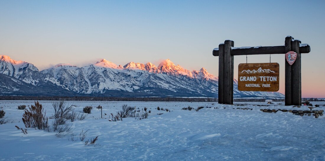
On February 26, 1919, Congress passed An Act to Establish the Grand Canyon National Park in the State of Arizona. The Grand Canyon of the Colorado River in northwestern Arizona is one of the earth’s greatest natural wonders. Comprising over 1 million acres of northwestern Arizona, the park includes the most spectacular area of the 277-mile canyon cut by the Colorado River. Still inhabited by Native peoples with at least 2,000 years of history in the area, some of the tribes of the Grand Canyon region are the Hopi, Navajo, Zuni, Paiute, Havasupai, and Hualapai. I will make it out there one of these days!! Also on this day but in 1929, Calvin Coolidge, in one of his final acts as president, set aside thousands of acres in Wyoming’s Grand Teton mountain range as a national park. Its original boundaries included just the Grand Teton mountain range and six glacial lakes. In 1943, President Franklin D. Roosevelt increased the acreage, including a disputed 35,000-acre donation from John D. Rockefeller Jr. that remained privately held until 1949. Congress added more land in 1950. Today, the park covers more than 300,000 acres.
Now, I have been here and can't wait to go back someday. Both are beautiful parks that we have here in the United States of America. Aren't we blessed?
1 Comment
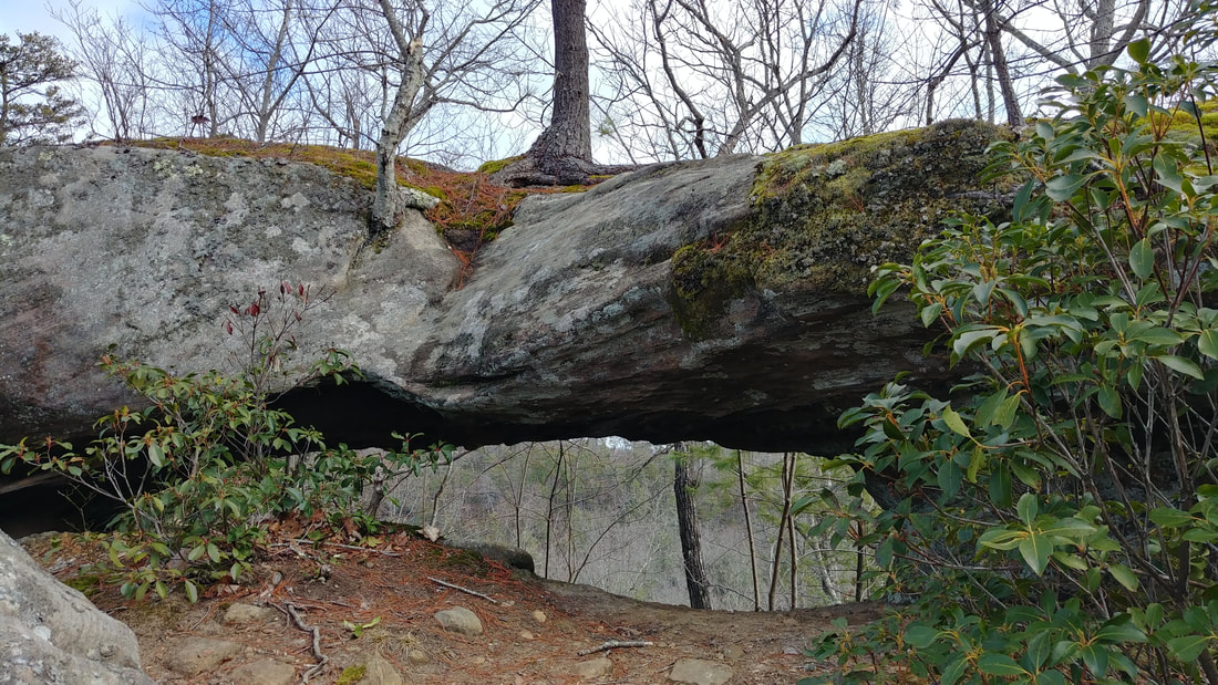
CAUTION: This is an unofficial trail with no markings and several side trails. With that being said, make sure to bring your maps, compass, GPS, or a phone with a GPS app. And, make sure you know how to use them. It is very easy to lose your bearings and get turned around. You will need to go all the way to the end of Tunnel Ridge road and park at the Double Arch trailhead which is there at the turnaround, not the Auxier Ridge parking lot. Make your way past the Forest Service gate and begin the 0.6-0.7 mile hike on the old roadbed. As the road makes a turn toward the right, there will be a well-worn path going to the left. Turn left there and follow this trail to about mile 1. You will know you are on the correct trail if you go thru another Forest Service gate shortly after you turned off the roadbed. You will pass camping areas and some other unmarked trails. But when you get to that 1 mile, give or take a little, turn right onto another well-worn path. This will be the unmarked trail to Star Gap Arch. Up to this point the hike is easy. It continues to be an easy hike if you stay up top of the arch. But if you want to see it, which I highly recommend, you will need to do a little scrambling. Star Gap Arch is one of the largest arches in the Red River Gorge and it is gorgeous. Nearly 2/10ths of a mile you will come to an exposed rock where the trees give way to a great view and if you stop there, you are now standing on top of the arch. My husband and I went across and hiked maybe another 0.1 mile but decided to turn around and get down to the arch. When you do turn around and are heading back, once you get back across the arch you will notice, if you didn't already, there are several spurs off of this main trail. This next step is totally up to you and your experience. Take a peak at these little trails which go off to the right and see which one you feel comfortable doing. I don't recall which one we did, but I do know that we had to do a little squeeze between big rocks and then continued on towards the arch. Going back we went another route that looked easier for us. So take your time, be smart and stay safe! It is a dangerous area. But isn't this amazing?! I didn't get a whole lot of pictures and I'm really upset at myself for it. But that just means you have to go see it for yourself! This arch is huge! A whole lot bigger than I expected. So get outside and enjoy this fresh, crisp air and stay safe!
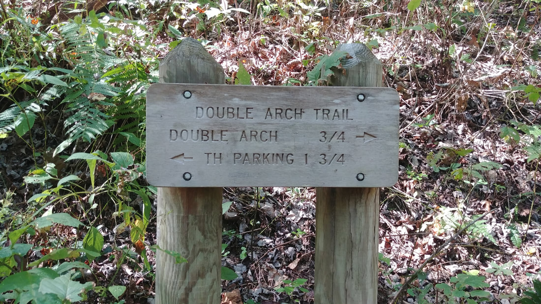
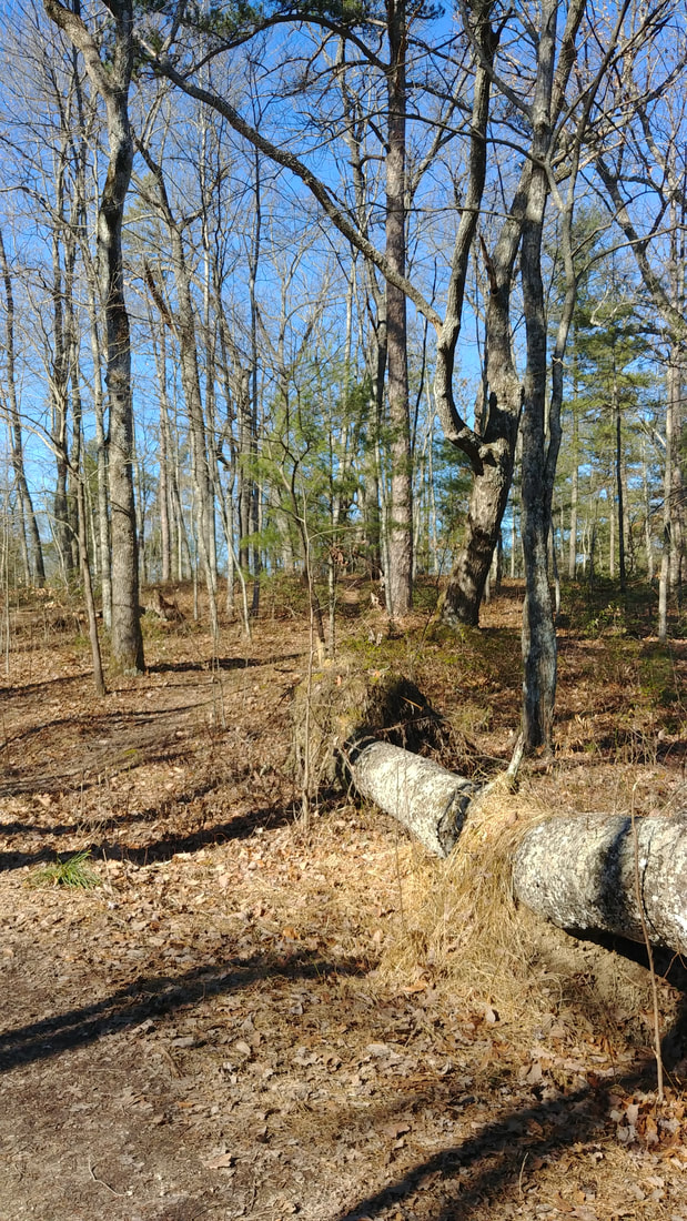
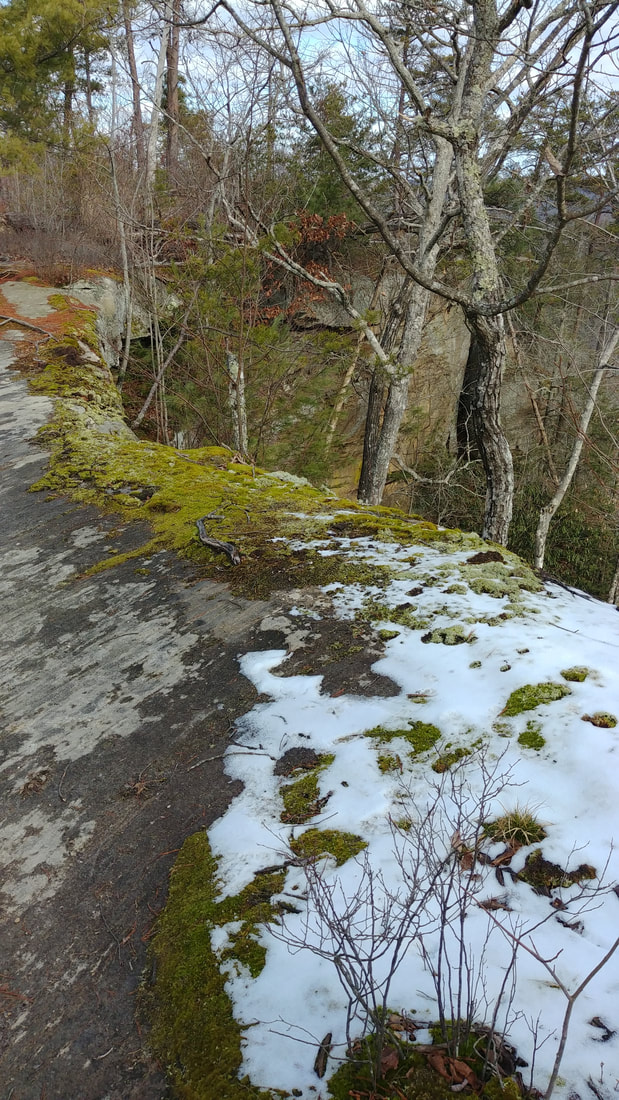
“Of all the paths you take in life, make sure a few of them are dirt.” Although the picture above is incorrect for this hike, I wanted to post it first simply for the fact that you will be hiking the beginning of Double Arch trail. Take Tunnel Ridge Road all the way to the end and the trailhead is there at the turn-around which is also where you can park. This is the first unmarked trail I have posted on here. So I want to remind you to make sure you have a GPS, GPS app, map, charged phone, or compass with you. And, make sure someone knows where you are. It is really easy to get turned around and eventually lost. Be prepared no matter how short or long you plan on being out. After departing the turn-around area, you will take the Double Arch Trail for about 0.2-0.3 miles. This is actually a forestry road which makes for a very smooth and easy walk. Soon you will notice the downed tree on your right, pictured above. This is just before the well-worn trail that is also to the right. If you look closely in the picture, you can see the trail. As you get up top of the little hill you will walk thru a campsite and continue on the trail straight ahead to another campsite. Once again, go thru and then downhill just a bit. You will see this exposed rock pictured above. This is the top of Arch of Triumph. If you look left, you will see the trail that will take you to the arch below. If you look to the right you will notice that there is a HUGE drop-off. Have fun but be safe. Enjoy the little arch and enjoy your time outside. Then when you are ready, simply retrace your steps back to the Double Arch Trail and then back to your vehicle. I didn't track the actual mileage, but I know it isn't even one mile. It is a trail I have passed many, many times and finally decided to check it out one day. I am so glad I did! Even though it is a small arch, it is still worth seeing.
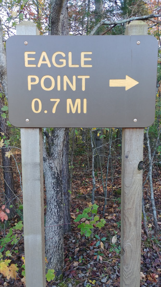
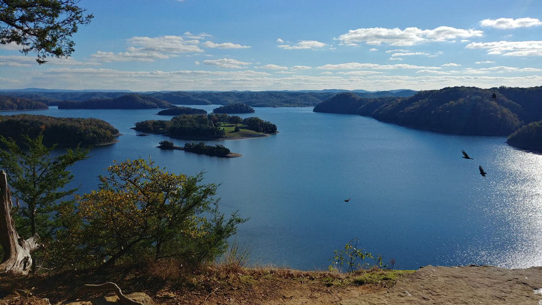
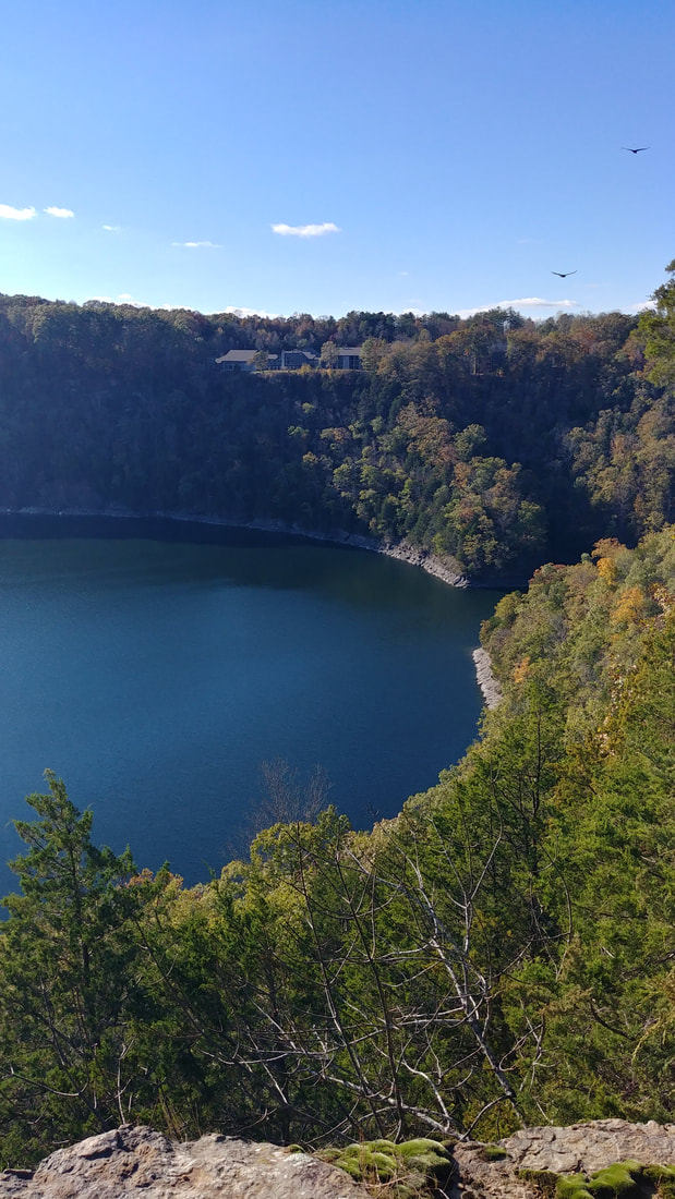
Yes, it is winter. But it is still great hiking weather. Grab your pack and have fun! 'Of all the paths you take in life, make sure a few of them are dirt.' - John Muir My husband and I went on an overnight trip to the Dale Hollow State Resort Park. It is smack-dab on the Kentucky and Tennessee border. After checking in and plenty of daylight yet to go, we decided to hike this short and easy trail. Even though the first couple hundred feet or more is an incline, and you have to walk over some really big roots at times, the trail itself is truly easy. As you can see, leaves covered the trail and made for a great fall hike. But those leaves can also make it easy to lose the trail. This path was well used, making it obvious. Now the other hike we took, over to Cindy Cave, was a different story. We actually did go off the trail unintentionally, but quickly realized it...back-tracked...and got back on the correct trail. I was very disappointed in the fact that the trails are not marked well. It made me really appreciate the great markers we have in the Daniel Boone National Forest. So if you go, make sure to have your map handy. We were told that if we can only go on one trail, it has to be Eagle's Point. I totally agree! Just look at this gorgeous view. The buzzards didn't understand, though, that this was EAGLE'S point and not BUZZARD'S point. Goodness! There were over 50 of them flying around! And even though they aren't the prettiest birds to look at, they fly so gracefully and are a joy to watch. In the picture below you can see the lodge over across the water while standing on Eagle's Point. When I reserved a lakeview room, I had no idea it was going to be this beautiful. (Yes, you are correct. The lodge is only about 50 feet from the cliff.) Isn't it just beautiful here? There is a big rock that you can sit on, relax and enjoy the view for as long as you like. This is another spot that I could sit and daydream all day. I love hiking in the fall, but we still need to be smart and stay safe. Dress appropriately and still take the necessities with you. You just never know what could happen. Have fun and be safe!
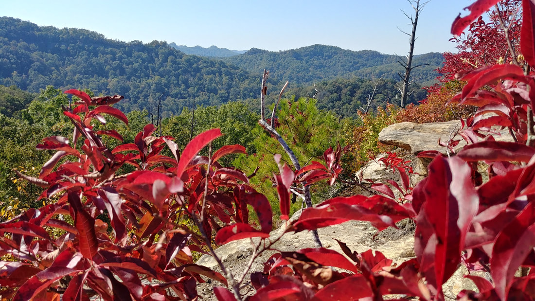
“Of all the paths you take in life, make sure a few of them are dirt.” - John Muir It is a wonderful time of year to get out and hike and I am so excited that I finally got to go on the Double Arch trail in the Red River Gorge. When you get to the end of Tunnel Ridge Road, there is a round-a-bout that you can park at and start the trail there. Just go around the gate and walk about 1.25 miles on a smooth, gravel forestry road. Makes for an easy start and finish to this awesome trail. When you come to a turn around area, notice that the trail goes to the right and into the woods. Now is when the difficulty changes from easy to moderately difficult. Not necessarily going to the arch, but definitely coming back out. Mostly because you will be going uphill and up the stairs you came down on. Almost instantly, once you are in the woods, you will see two trails. This is where you need to remember to follow the forestry signs painted on the trees. Specifically a white diamond. The trail you want to take goes to the left while a camping spot goes off to the right. You can easily get lost without even realizing it. And quick! There are a lot of roots and stairs, so be careful and watch your step. One of the most common calls the Search and Rescue teams get is because of a twisted or broken ankle. As you continue on, you will come to a split about a half mile in. The Double Arch trail goes to the left. I didn't see any snakes on the trail, so I am hoping the cooler weather is keeping them away! Although, one of the pictures below shows a really cool, huge rock that resembles a gigantic snake. The other photo is Double Arch. You may be wondering where the second arch is?? It is drastically smaller and directly above the big arch in that crack area. The only way to see it is from Auxier Ridge. That is the rock ridge you can see across the way while standing under the arch. If at all possible...don't stop here! Off to the right of the arch, carved into the rock, is stairs to get you to the top! When you are ready to come back down, and a little nervous about those stairs, you can go on past until you come to an area like what is showing in the second picture. It was pretty easy to scoot or walk down backwards like my husband is doing. Now that we are up, go over top of the arch and continue until you see a big flat rock. Walk on up and enjoy one of the most beautiful 360 views of the gorge. Take a seat and just soak it all in for a spell. Eat you a snack, drink some water and just enjoy God's beautiful creation. I tried to upload my 360 panoramic picture, but it's being stubborn. So this picture right here will hopefully put a little spark in those hiking boots and make you want to see the whole thing. From here, you will walk back the same way you came. When you get out of the woods remember to go to the left. This will take you back to where you parked.
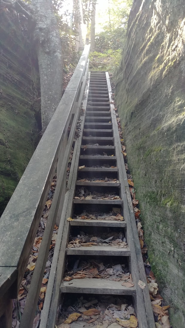
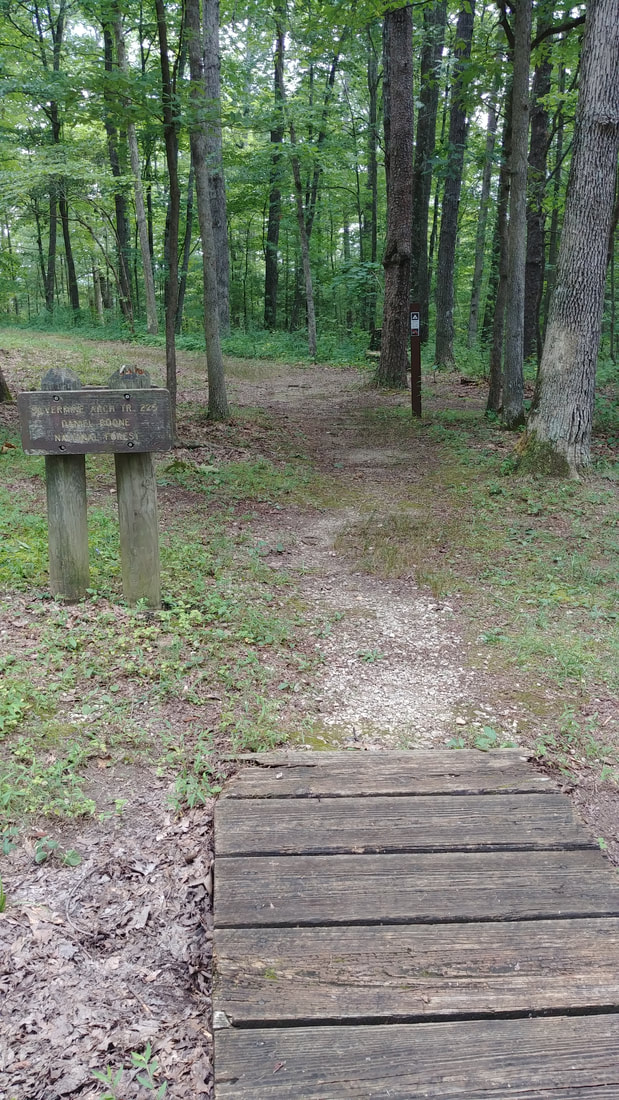
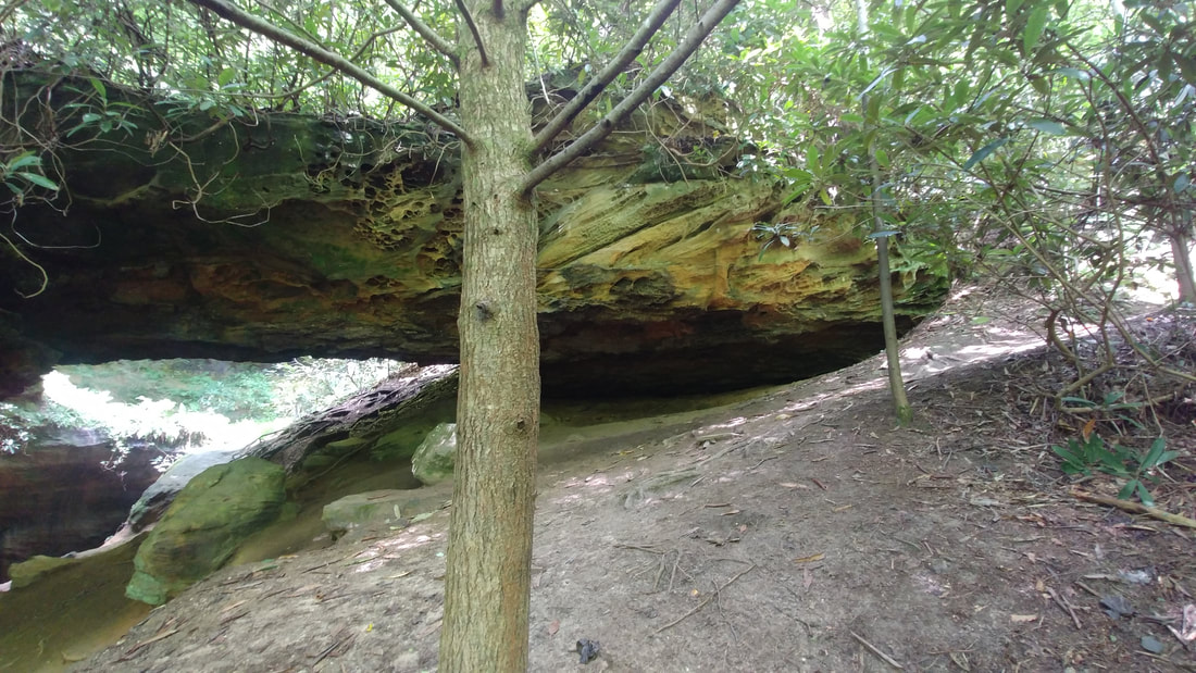
Stay safe y'all! Have fun and enjoy this beautiful fall weather! “Of all the paths you take in life, make sure a few of them are dirt.”― John Muir To get to the Silvermine Arch Trailhead pictured above, go to the Koomer Ridge Campground and stay to the right. Stay on this road until you absolutely have to go to the right because it is one way. As you round the curve you will see this sign on the right and on the left is a decent size bathroom. When you come in the winter and the campground it closed, you will have to park somewhere near the entrance which makes this 1.7 mile hike turn into a 2-2 1/2 mile hike. But shortly after you begin, you will come to another sign that will direct you to go to the right. The first part of this hike is very easy, so relaxing and makes for a really nice hike. But just as I was beginning to think that I could report it as being an 'easy' hike, my puppy-dog, Ranger, and I saw this.... I'm pretty sure he had the same thought as me...'that is a lot of steps we have to come back up'. 78 to be exact. 78 steps! Once at the bottom of these steps, the trail turns into the 'moderate' difficulty, simply because of the downhill grade, deep knee bends and more steps. Beautiful, wild rhododendrons...many different, colorful fungi...Pileated Woodpeckers calling...and huge boulders makes me feel as if I am on a remote island somewhere. I had a hard time finding a good spot where I could get the whole arch in the picture. As you can see, I never did find that spot. So this just means you will need to go and see it for yourself. Just remember as you head back out, once you get to the top of those 78 steps, it's a nice easy hike back to your car. I really enjoyed this trail. Very secluded and not busy at all. Stay safe! Have fun! Make sure to pack the necessities even if you don't use them. You never know what could happen. It is best to be prepared! And remember,
'Of all the paths you take in life, make sure a few of them are dirt.' - John Muir If you are like me, you want to hike as often as possible no matter what the weather is like. And our weather has been extremely hot and humid lately. I am a member of the Powell County Search and Rescue and we have been responding to a high volume of calls within the last couple of weeks. Many of these are due to dehydration and heat exhaustion. I want to share with you some ways to help your hike be enjoyable and safe. First thing to do is check the weather. This will allow you to know what clothing to wear. And right now with the heat we have been having, loose clothing is preferred. It allows for better airflow which in turn helps keep you cooler. Second, choose your trail wisely. Believe it or not this is one of the most important things to do during this heat. There is a big difference hiking on a ridge in the sun to hiking on a lower trail that is all in the shade. Find out the difficulty level and the distance, also. Third, start early to avoid the midday heat. Miss Katelyn, one of my wonderful co-workers at WSKV, joined me for a hike last Friday on the Skybridge Trail. The first thing we decided was to do it in the morning. And then I chose this trail because it was one of the shorter ones in the gorge and not to strenuous. Well, that is if you start on the trail instead of the bridge. Make sure to do this! Everyone is usually excited to see the bridge first. But if you do that you will have to go up a ton of stairs at the end followed by an uphill grade all the way back to your vehicle. Fourth, and I cannot stress this enough, take plenty of water. Sweating profusely is a given on a hot weather hike and drinking water is essential to restore your body fluid levels. It's also just as important to replenish the electrolytes you lose through sweating. They play a major role in managing your energy levels. So put a small Gatorade and some salty snacks like a trail mix or energy bars in your pack, too. And now for my last tip.
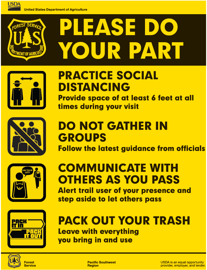
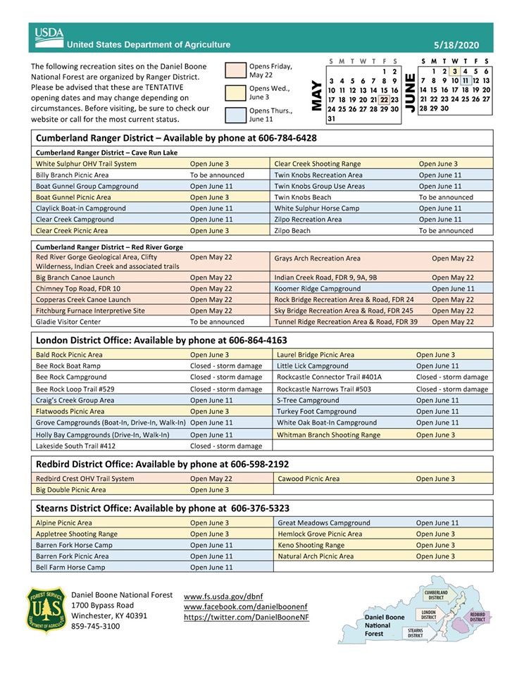
Fifth, don't feel you have to prove you are in shape. Take breaks! Find a log or a big rock, sit down, pull out your water and snacks and enjoy the scenery. Give your challenged body some much needed rest. Regular breaks also lets your body cool down. Be careful y'all. I want you to enjoy this beautiful area we live in, but I also want you to get back home safe and sound. OH!! Don't forget bug spray!! Skybridge trail was horrible with flies and deer-flies! The combination of hot and humid weather, a shady forest and a sweaty hiker often results in a swarm of irritating bugs! Hi there! Has this been a wild and crazy start to our year, or what? If you are like me and so ready to hit the trails, I encourage you to join me in doing it in a safe, healthy and respectable manner. I know we are excited and anxious to get out there but please take a moment to read this and please make sure to do your part. Do you need some ideas on what trails to go on? You can always read my blog posts or you can check out this page for free maps that can easily be printed! https://www.fs.usda.gov/activity/dbnf/recreation/hiking If you are thinking about going somewhere other than Red River Gorge, below is a list of other areas and their tentative opening dates. Now, get that pack ready...hiking gear on....and don't forget your water! Stay safe y'all and Happy Hiking!!
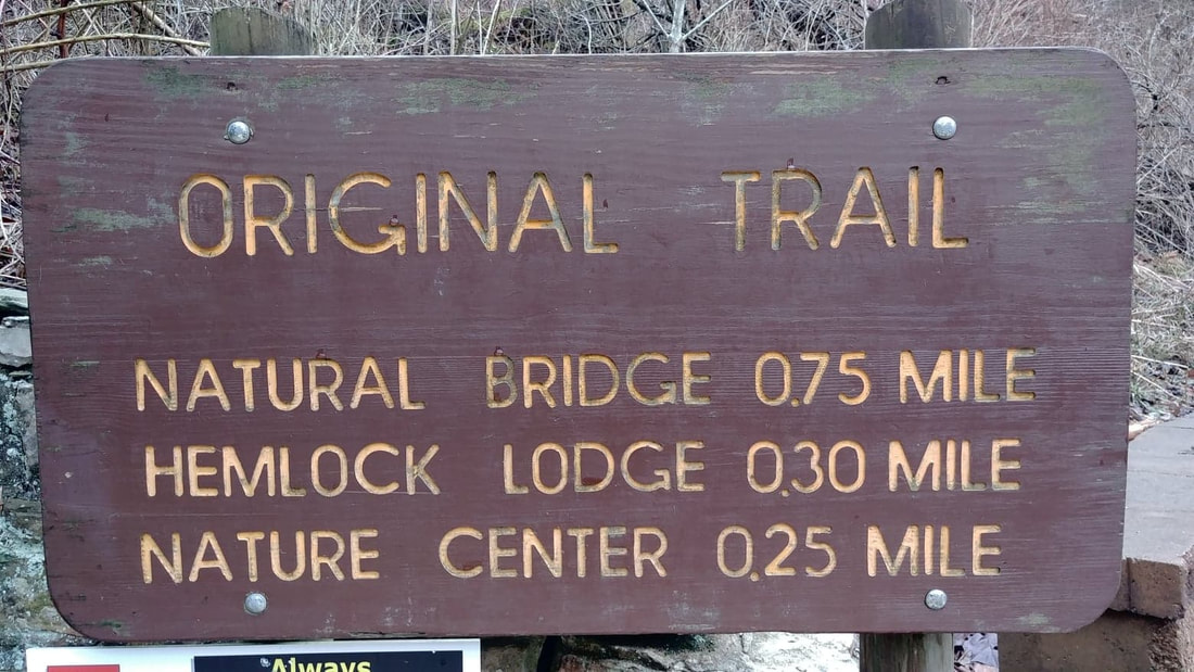
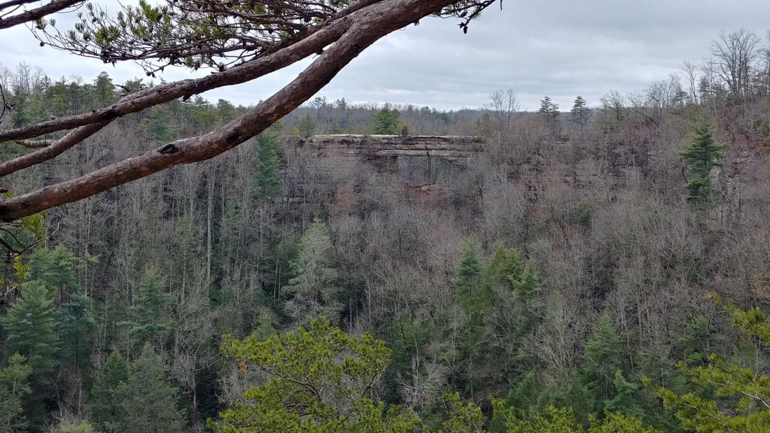
We have had the absolute best winter weather for hiking this year! Well...when it isn't raining! I hiked this trail a couple of weeks ago and knew it was going to be great because the parking lot was totally empty. And I was not disappointed. This is probably one of the busiest trails in the are. So a quiet trail...by myself...tends to lead to a wonderful conversation with God. I was going thru my list of trails that I have wrote about and could not believe I have not shared this one with y'all! My sincerest apologies! I wish everyone had the opportunity to stand on top of this gigantic natural bridge. But not everyone can make the hike. It is rough. It is a gravel/paved/dirt trail that starts right off with...yep, you guessed it...stairs. Whether it be wood steps, rock steps or poles across the trail, there are well over 200, maybe even closer to 300, steps! Now, I always park at Hoedown Island and head up that way. So maybe there is somewhere else to park that would eliminate some steps. Let me know if there is! Thankfully, though, there are shelters and benches all along the way. Use them folks! Don't be embarrassed or ashamed. This is a hard, uphill hike and I want you to get to the top! There are a few informational signs along the trail. Take a breather and read those as well. They are very interesting. This is a wide trail with lots of room. At one point there is a sign that mentions this is the easiest trail up to the bridge. It always cracks me up!! Easy?? Maybe coming down. If this is your first time, know that once you get to the bridge you are not finished. One of my favorite parts of this hike is getting to the top! If you notice in the pictures below, there is a tiny trail that goes between the bridge and another huge rock. You go thru there! Kids love it! I love it! It is seriously one of the highlights of this trail. I took a picture of my foot on one of the steps to show you just how tight of a squeeze it is. Now you are almost to the top! A few more steps to go! Now, take it all in. Find a spot to sit down and take in the view. Since I knew this was an opportune time to get a picture of the bridge with no people on it, I went on ahead and hiked the easy trail over to Lover's Leap. It took me about 10 minutes to get over there. But it was so worth it. Look at this beautiful picture! We are blessed to live in this gorgeous part of Kentucky! Please be safe when you are up top and please do not throw rocks off the bridge. Someone could be down below.
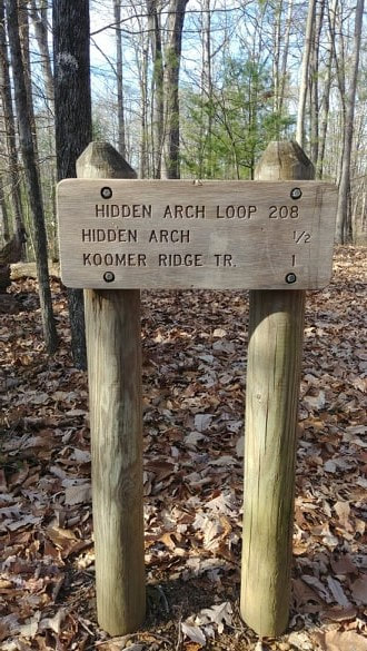
Bundle up, grab your daypack and get outdoors! I would love to hear if you hike it! Be safe y'all! 'Of all the paths you take in life, make sure a few of them are dirt.' - John Muir We have had a plethora of warm days in December! This is the perfect weather for hiking. Not to cold and not to hot...just perfect. Hidden Arch trail is a very nice trail to hike. Easy in and easy out with moderate difficulty in between. As you look at the pictures above, I want to bring a couple things to your attention. Be careful as you walk on all those leaves. They can be very slippery in spots and they also make it a little tricky to see the path in areas. If you do get confused, remember to look for the white diamonds that are painted on trees to mark the trail. There is a small area that gets pretty narrow and another spot that has a good size rock with tree roots that you have to climb up to stay on the trail. Nothing major, just wanting to make you aware. And what is a trail without stairs? Gotta keep that cardio going strong, right? What I have pictured is all there is, though. So it's not that bad. To get to this trail, go to Koomer Ridge Campground. Right now, since there are no campers, drive on down to the campground road to the left. It starts out as Koomer Ridge Trail #220 with Hidden Arch turning off of it about 1/2 mile later but rejoining it on past the arch. So this makes it a loop trail that is about 2 miles out and back. Perfect hike for this weather! Stay warm, be safe and have fun! Even though it isn't hot, still be sure to pack water an snacks. And remember,
'Of all the paths you take in life, make sure a few of them are dirt.' - John Muir |
AuthorAngie Gable Archives
February 2021
Categories
|
Home | Tradio | Contact | Service Portal | Employment (EEO) | Better Radio Reception
[email protected] - Office: Stanton or Irvine (606) 663-2811 - Fax: (606) 663-2895 - Text: (606) 663-2811
All Rights Reserved Moore Country 104, LLC 2009, 2011, 2014, 2020
..::Login::..
We use third-party advertising companies to serve ads when you visit our Website. These companies may use information (not including your name, address email address or telephone number) about your visits to this and other Web sites in order to provide advertisements about goods and services of interest to you. If you would like more information about this practice and to know your choices about not having this information used by these companies, click here.




 RSS Feed