
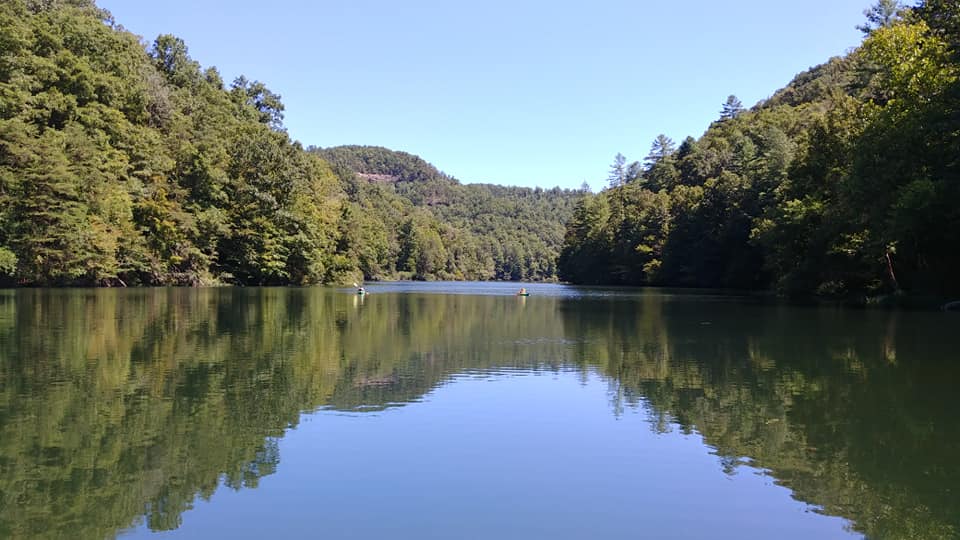
 This beautiful lake is just past Natural Bridge State Resort Park on Hwy 11. As you round the curve by the campground the lake is on the opposite side of the road. Tucked in and away so neatly that it is easily missed. 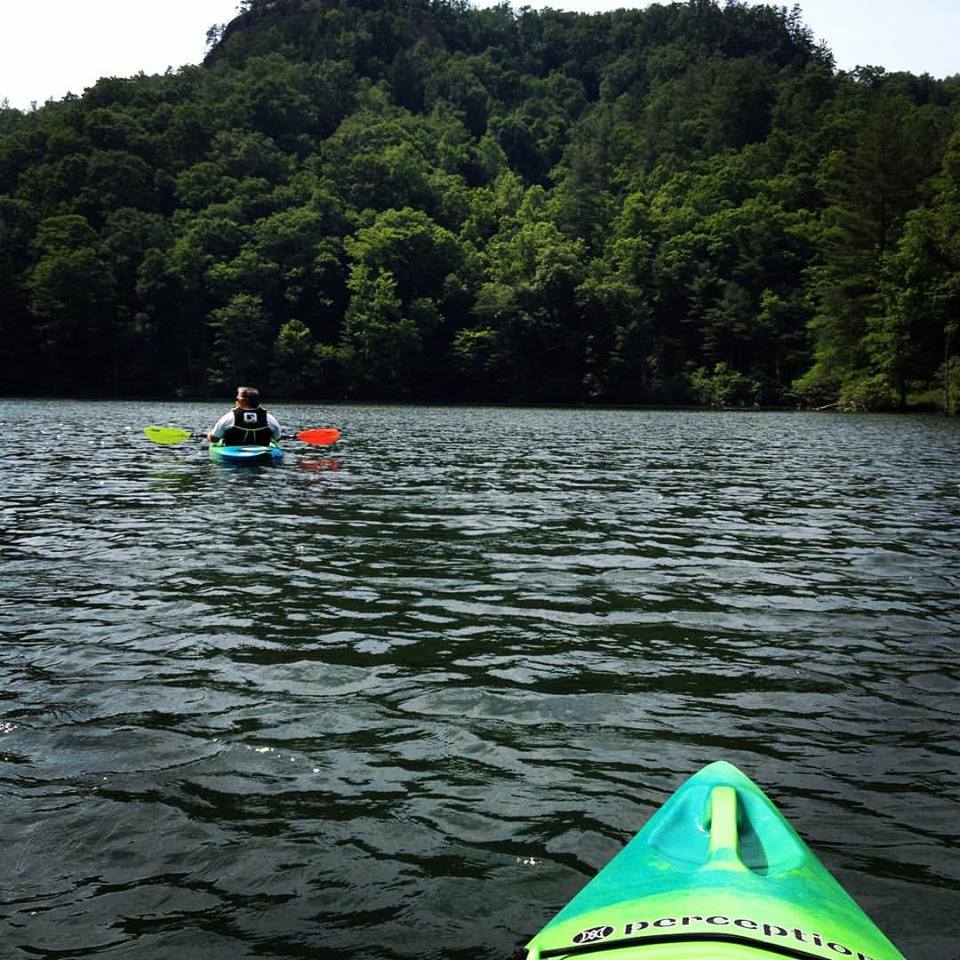 Once on the water, you are totally surrounded by a gorgeous, dense forest. I love how quiet it is. The only sounds I hear are the rustling of the leaves from a gusty breeze, water lapping against my kayak and birds singing their songs. 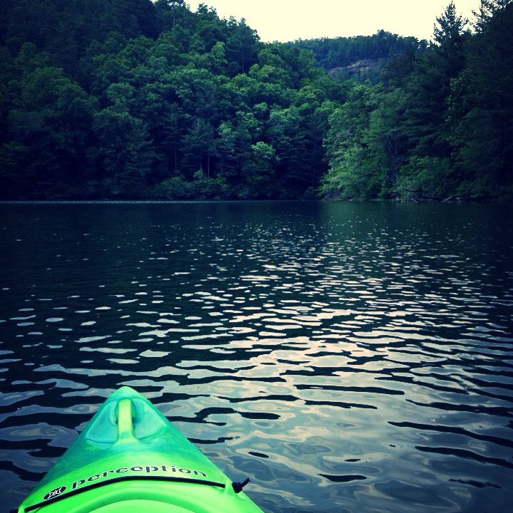 The lake is around 95 acres which makes it a nice couple hour float. If you enjoy fishing, I have seen some giant bass and decent size crappy in here. It is a trolling motor only lake, which is fine with me. I will be the first to admit that I am a wimp when it comes to choppy or fast moving water. I love the peacefulness of calm waters. 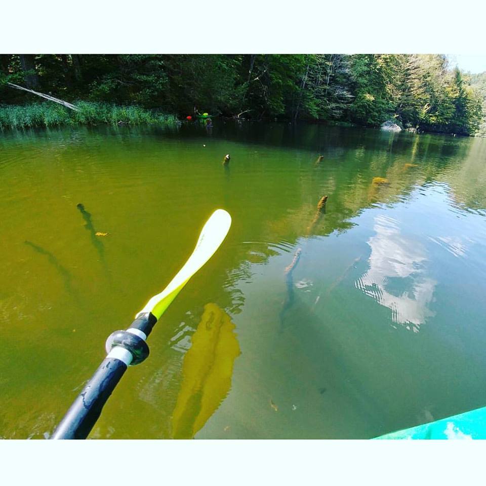 And then we come to this picture. The farther back you go the more clear it gets. This area freaks me out! I guess I have watched one to many scary movies. I could look over the side of my kayak and see a good 10' down. When the water is that clear and I can't see the bottom?? Yep, freaked out. 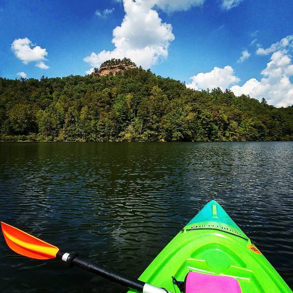 But then all I have to do is look back up and see this view. Absolutely gorgeous! So since we are having crazy hot weather for September, what better time to get out on the water! Get your PFD (life jacket) on along with some suntan lotion and check this beauty out. Be safe and have fun!
0 Comments
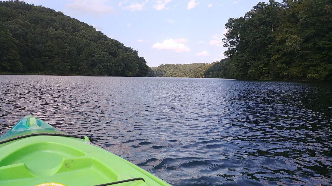 I am a huge fan of state parks. They have some of my favorite things! Hiking trails, lakes, lodges with restaurants and gift shops, cabins and usually some good old peace and quiet. Greenbo did not disappoint! 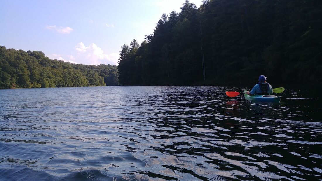 This trip was all about sweet time with my husband, kayaking and rest. Lakes that allow more than idle speed are not my idea of rest. At least on a kayak. And for those reasons, Greenbo Lake was perfect. We paddled over 4 miles on smooth water with beautiful scenery. While out in the middle, the water was so dark, almost black. But the closer we got to the shoreline, it turned a beautiful emerald green and was extremely clear. Most of the surrounding forest was your typical maples, oaks, sweet gum and so on. But we soon came to an area where it was nothing but evergreens. It was almost like we were on a completely different lake. And it smelled wonderful! We were also blessed to see a deer come out of the woods for a drink. (I drew an arrow on one of the pics below so you can see it...kinda.) Pay attention to your surroundings and take it all in. You never know what you will miss! And although there was a steady breeze, the sun was very hot. The awesome part, though, of being in a kayak, is you can quickly cool yourself off! So if you need a new place to kayak, and don't mind driving just over an hour and a half, Greenbo Lake is highly recommended. And an added bonus is if you are a Kentuckian, you get a lodging discount! Have fun y'all and be safe! Always, always wear your PDF. Let me know if you go! 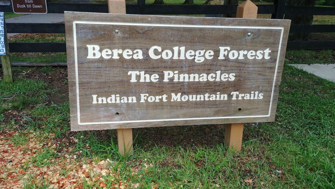 If you are looking for a hike outside of the Red River Gorge, try The Pinnacles just outside of Berea. This little park area has a few trails to the West and East Pinnacle and a beautiful overlook called Indian Ford Lookout. If you have never been here before, I highly advise you to see the lookout. But let me tell ya, it is straight up and I'd like to die! But so worth it! It has been about a month since my last hike! I have been wanting to get out, but this heat and hiking really don't mix that well. So we chose to hike out to see the West Pinnacle in the morning and made sure to have plenty of water. 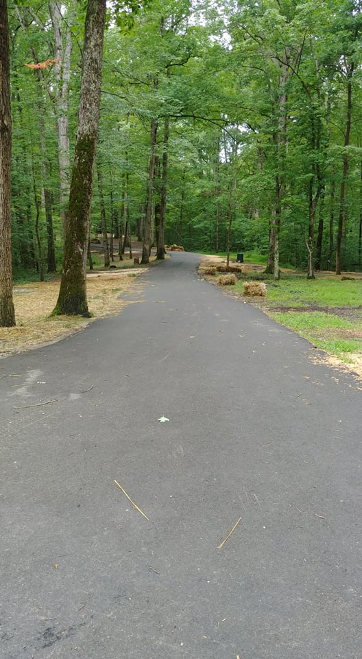 After leaving the huge parking lot, you will take the paved trail marked by the sign in the picture above. This will lead you to the trailhead and also a very nice map. There you will see all the trails they have to offer. Once you begin going uphill it don't end for a long time. So take breaks. Enjoy the scenery around you and catch your breath. I did about 3 times! As you can see from some of these pictures, the trail can be nice and smooth at one point, rocky at another and very much filled with roots in another area. The trail will come to an intersection and you will want to turn to the left. There is a really nice bench you can rest on before you venture on. One of the nice things here is that their trails are very well marked with nice signs. 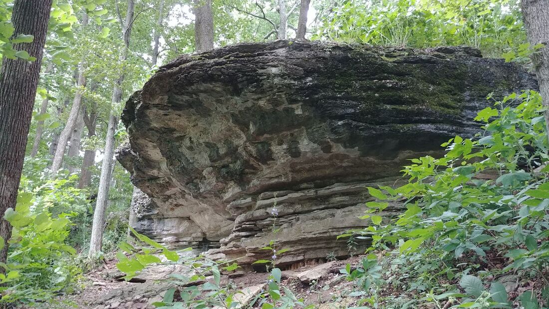 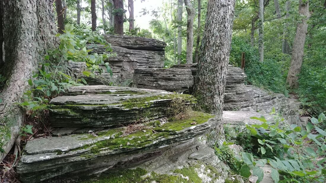 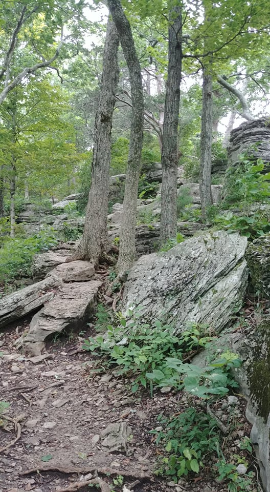 Yep, the trail goes right up in all these rocks and trees. The closer you get to the pinnacle the more difficult the trail becomes. Climbing rocks and squeezing through some tight spaces. But isn't that part of a fun adventure? There was a time or two, though, when we wondered if we were there or not. We were getting a little bummed because we weren't finding a wonderful opening where you can overlook the valley below. But we found it! So just keep going until you can't go anymore. We climbed up on of the pinnacle and was able to see part of our state's beautiful scenery. I will say, though, that it may be better to do this hike in the winter or beginning of spring when the leaves are off the trees. You only have a couple spots with a good view. Although this trail is in the shade, remember to pack plenty of water. So go grab you camera and have fun! And remember...“Of all the paths you take in life, make sure a few of them are dirt.” - John Muir
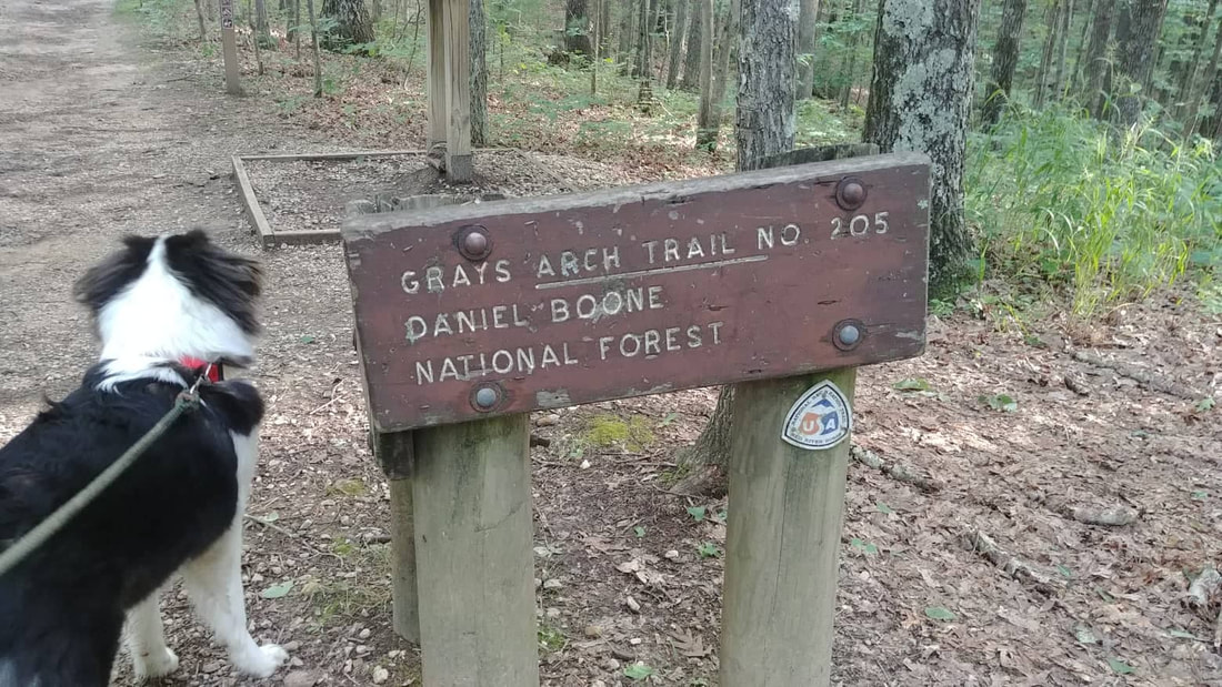 For one reason or another, I have never hiked to Grays Arch until now. I have lived here in Powell County for almost 13 years and I can't begin to try and calculate all the miles that I have hiked in the Red River Gorge. But for the life of me, I cannot figure out why I have let this gem of a hike sneak by me! I love this trail! So much so that I came home and told my husband that we HAVE to do this together soon! As you pull into the parking area, you instantly see picnic tables scattered around and all of them in a beautiful setting, If you don't want to hike and are just looking for a new picnic spot, this is really nice. There are even 2 bathrooms close by. This trail was absolutely wonderful and easy for the first, I'd say, 2/3rd's of the way. Extremely flat with no uphill or downhill whatsoever. It is around 2 1/2 miles from the parking lot to the arch and back. I didn't do the loop trail because Ranger is good for about 2 miles. Any further I would probably have to carry him. The wild rhododendrons were blooming and you can see some pretty views if you take one of the short paths that veer off the trail. But! Only if you stay a good distance from the edge! I saw we had another serious injury this week in the gorge. Please be safe y'all. Once you notice you are starting to go downhill, you will pretty much continue that until you arrive at the arch. The cool thing though, is that when you head back you know that it is smooth sailing once you get up top to level ground. The next few pictures are of the rocks, steps and you guessed it...stairs. SHEW! When I came to this next spot, I thought I was there! There is a wooden fence with a very well worn path on the other side of it. And if you look real close, you can see the arch. So I just figured you must go around the fence, stay on that path and quickly get to the arch. But my instincts kicked in, saw the diamond on a tree and I continued on the same trail I was on. It sure confused me though. The arch was right there! Why was the trail going away from it? 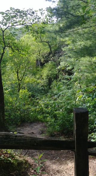 I cannot stress enough to stay away from the cliff edges. If I would have taken this other path, I would have been on top of a huge rock wall, that you will see when you get to the arch, that is extremely high. One slip of the foot and it's all over. I am so thankful I stayed on the trail. It did eventually lead to Grays Arch. I was absolutely in awe of the size of this arch! I was bummed because I couldn't get a good picture of it no matter where I stood. It is so massive! It is pretty difficult getting up underneath of it, though. My puppy-dog, Ranger, even had to think about his next steps. So when you do get there, grab a seat and take it all in. Drink your water and grab one of those snacks you brought. It is stunning.
Take advantage of this AMAZING cool weather we are having! Grab that camera, be safe and have fun! 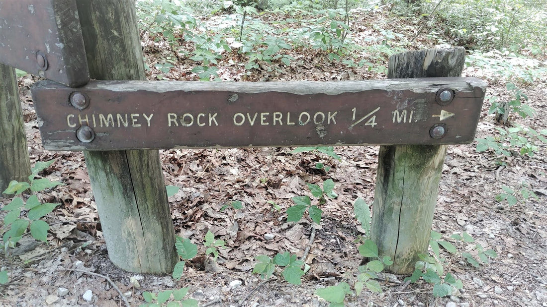 I have not been on Chimney Top for years! It also has been awhile since I have taken our puppy on a hike. So I thought that this trail would be perfect because not only is it easy, it is also quick. Well, unless you decide to chill out at the overlook. Overlooks are like a campfire for me. I can just sit there and stare off into wonderland forever! 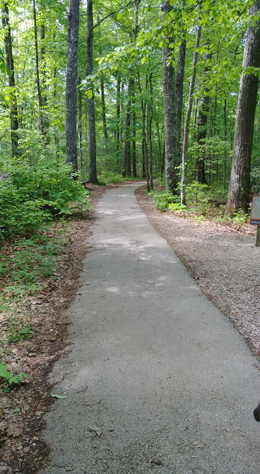 As we started on the trail I was so excited to see a paved path! I thought I could finally write that we have a trail that is wheelchair friendly! But it saddens me to say that it is not. The pavement turns rough and more like gravel and there are a couple hills that I think would be hard to push/pull someone. It is still a nice, easy, little hike, though. 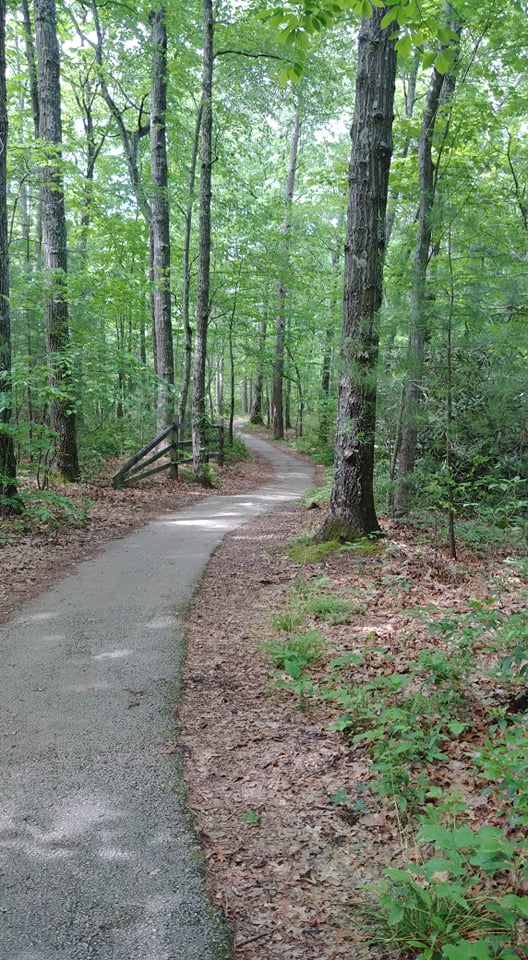 You only have to walk .25 miles to see one of the most beautiful overlooks in the Red River Gorge. As you can see from my pictures, the view is amazing! But even more important is that you can see those views at a comfortable distance from the edge. Please be safe y'all! Choose to get outdoors more and see this beautiful area we live in!
'Of all the paths you take in life, make sure a few of them are dirt.' - John Muir 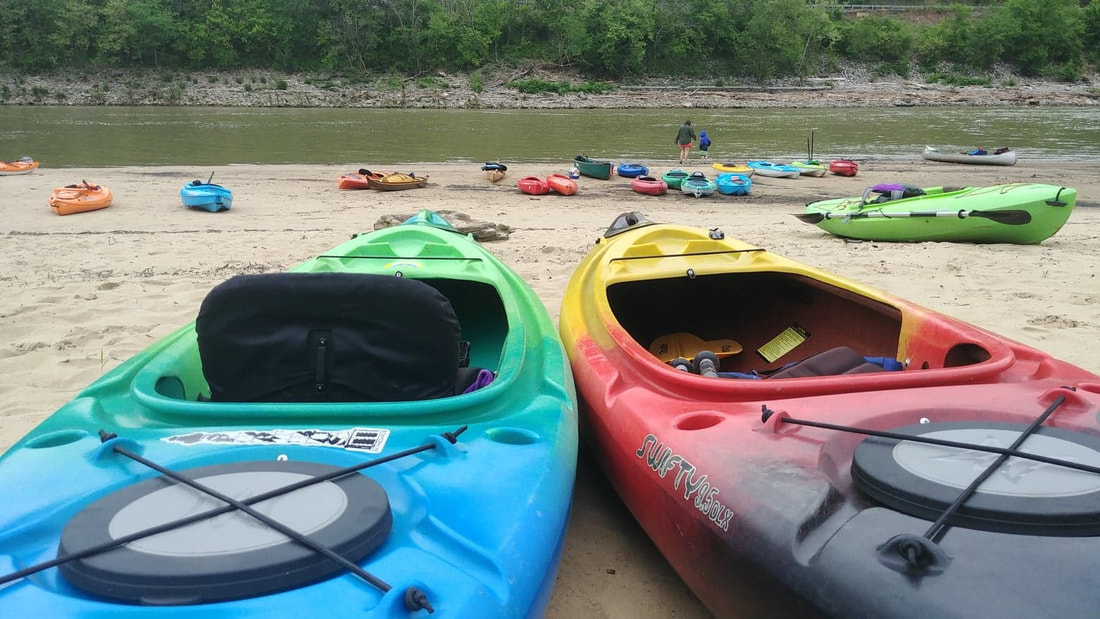 I am out of the woods and into the water in this post. It's kayak season! This last weekend I was able to participate in the 3rd Annual Bluegrass River Run at Fort Boonesborough State Park. If you enjoy kayaking or canoeing I highly encourage you to be part of this next year. Not only was the camaraderie with fellow participants great, I also got to spend time and have fun with one of my boys. I have been wanting to kayak on the Kentucky River for a few years now, but for one reason or another I just never got around to doing it. But if I'm honest, it's probably due to not knowing how quick or strong the river current was and how much debris I would have to paddle around. But I did it and am so glad I did! Not only was the current extremely slow, there was truly no debris. This makes for one nice float. And to top that off, the stretch between the park and Proud Mary's BBQ (take-out), is absolutely gorgeous. One of the first cool things I noticed was this huge hole in the side of the cliff. My son thinks it is a vent of some sort. I just think it is cool. 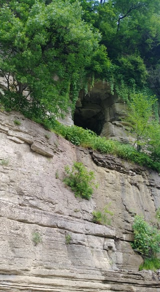 Another highlight was watching Blue Heron Cranes landing in the tip top of a tree! I have never seen that before! I always see them on a branch close to the water or them standing in the water. But as I floated closer I noticed that this tree was FULL of them. If you look closely at the photo below you can see black spots all over the top of the tree. Those are nests! So cool. 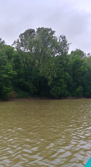 On this trip I learned that our state's namesake river is 260 miles long, about one-third of a mile wide and has an average depth of 20 feet. The river is broken up with a system of locks and dams every 15-20 miles. 100 miles of the river, including the stretch we floated, is within a canyon system called the Kentucky River Palisades. We live in such a beautiful part of the state y'all. Just as we round the bend to the take-out spot, there is a waterway off to the right which is Boone Creek. Of course we had to check it out. We were able to go in a little ways but had to turn around because of a fallen tree blocking any further access. The little bit we floated was really neat! And then, before we knew it, 2 hours had come and gone and we could start hearing the roar of I75. Up ahead we saw the bridge and new the float was coming to an end. Although my arms were pretty tired, I would have loved to keep going. But now I know that I love kayaking the Kentucky River. I hope that if you haven't and been thinking of doing it that you try this stretch. You will love it! Please wear you PFD at all times when floating. Take some water with you and maybe even a little snack. But most of all have fun and #optoutside! 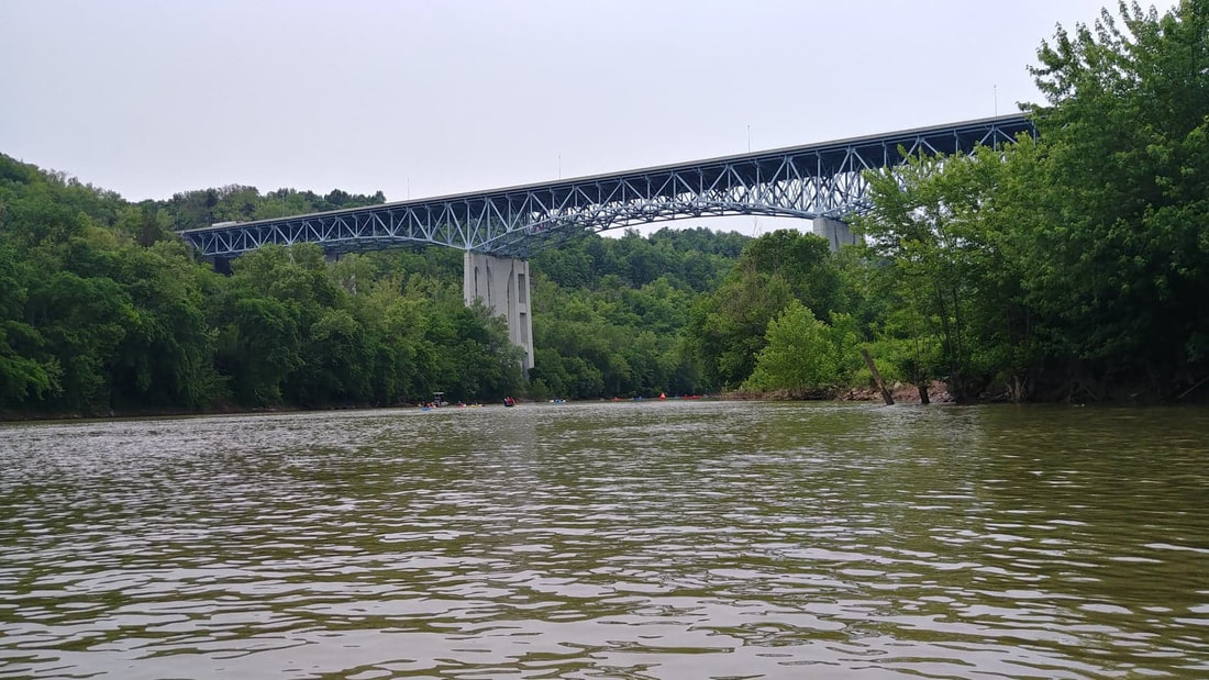 This trail is a connector to Auxier Ridge Trail #204. Making for a decision to do an out and back or a loop hike. In my opinion, which you will know if you read my last blog post, I highly recommend doing the loop because the views on Auxier Ridge are absolutely stunning. And if I got my calculations right, either way you will be hiking a total of 5 miles. I'm sorry the quality of the map isn't the greatest, but I wanted you to see exactly where this trail is. The parking area is decent size and also has a bathroom. 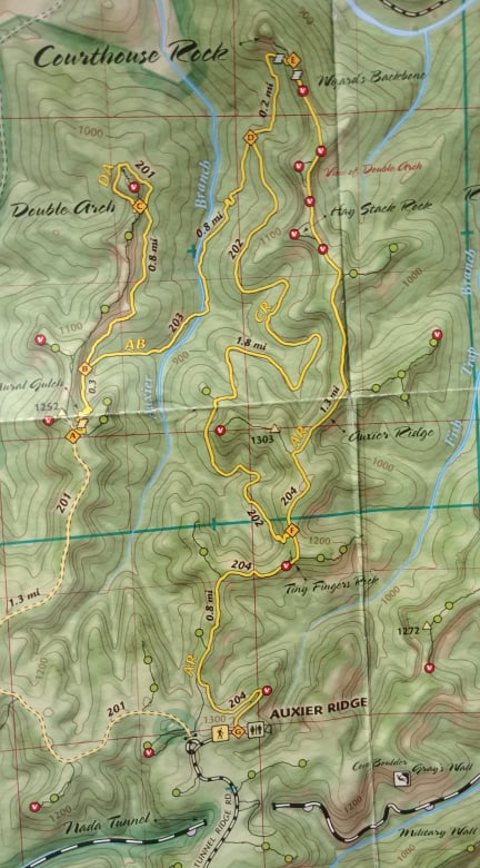 The reason I consider this trail difficult is mainly because of how you get onto the trail...from either end! If you hike the Auxier Ridge Trail to the end and get on it there, it is about a 3'-4' drop, instantly. I honestly questioned if it was the trail or not because it looked extremely difficult to get down. But, there was a couple who just came up it, with their trekking poles, mind you. So I had my typical thought, 'if they can do it, I can do it!' And I did! Then I remembered that I didn't get a picture of the sign. Argh! So instead of figuring out how in the world I was going to climb back up that mess, I just lifted my phone in the air and snapped this picture. It gives you an idea of how far down I am and how fast I got to that point. Maybe someday soon we will have steps put in there. 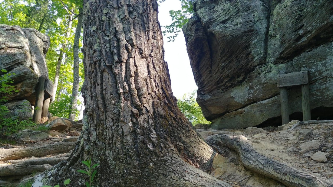 For about .2 miles you are actually still on the Auxier Ridge Trail. But soon you will come to a split that will take you on the Courthouse Trail #202 (on the left) or the Double Arch Trail #201 (on the right). I'm thinking my next hike will be the Double Arch Trail.  As I got onto the trail and all along the way I couldn't help but feel I was in fairyland. The pretty spring flowers are in bloom...beautiful ferns everywhere...and lizards. I can't tell you how many times I got a little spring in my step because of hearing the little guys rustling through the dry leaves or scurrying up a tree and even running across the path right in front of me. After I realize it's not a snake I go back to my normal pace...hee, hee! Because of the grass growing on the trail in spots, it makes me think it isn't a very popular trail. And if I am honest, it is going down as one of my least favorite. Not only is is a pretty hard trail because of the incline, but there is just nothing to look at. Nothing that catches your eye. And by now you know that I love seeing awesome things and taking pictures. But if you are wanting a peaceful, quiet walk in the woods and are up to a good workout, then this trail is for you. I did enjoy seeing all the wildflowers and the little grove of Bigleaf Magnolias towards the end of the trail. And you know? Just the fact that I was outside in the forest still makes it a great trail. 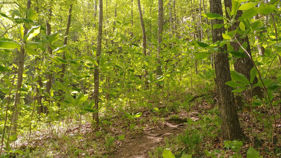 It is getting time to add a few things to your pack when you head out. Bug spray and more water. I can't stress enough about being safe out on these trails. Some things I always have in my backpack are: wallet, keys, phone, plenty of water, a couple Cliff Bars, chapstick, knife, whistle, maps and a small first aid kit. I'm sure there are more things I should pack but I feel I have a good start. I would love to hear what's in your backpack!
Also, whether you are hiking alone or with someone, always make sure someone knows what trail you are taking. This last week I even went into detail letting my husband know I was starting on Auxier Ridge and coming back on the Courthouse Trail. As much as you think you are invincible, accidents happen. And hopefully it never does, but better to be safe than sorry. I just want y'all to be safe! So hopefully you can get out sometime soon and enjoy our beautiful Red River Gorge or other trails around our area! Have fun and be safe! Don't forget that camera! And remember... 'Of all the paths you take in life, make sure a few of them are dirt.' - John Muir 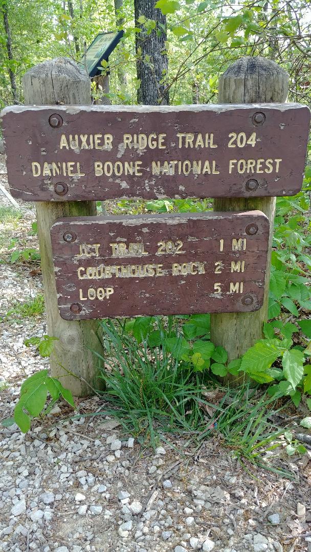 Happy first of May! Hiking weather is officially here and I couldn't be happier! And to make things even better, I hiked my absolute favorite trail yesterday...Auxier Ridge. When I hike, I love looking at the scenery and all that is around me. When I have to stop every few feet because of an awesome view or a really cool boulder that I just have to get a picture of, well, then I consider that a great hike. And this trail has that from the start! I took so many pictures, y'all!! 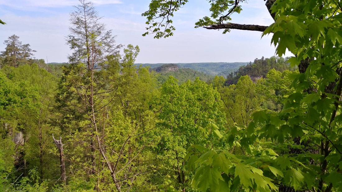 Raven's Rock in the distance 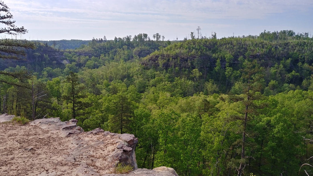 God's beautiful creation These are views within the first 100 feet of the trail-head! Remember, this is a ridge trail. So get ready for amazing views for the whole 2 miles out. 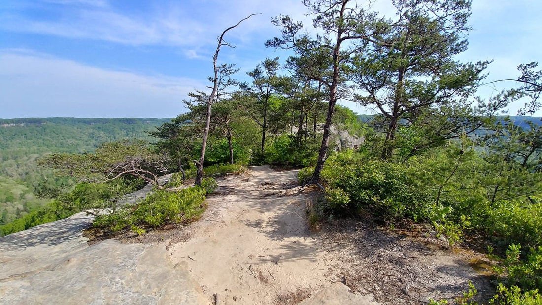 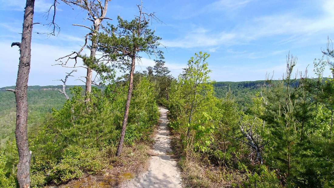 They definitely named this correct! You are up on top of the mountain, right on the ridge. But let's also get to the trail itself and let me tell you why I feel it is difficult. Besides the views, another reason I love this trail is that it isn't just walking on a dirt path. One minute it is level and smooth but then the next you are walking in a washout dodging little lizards. There are steps carved in rock....roots that have grown over the path to make the perfect steps....also, actual rock steps that I believe were just recently put in last year. Then there are the areas that you either slide down the sandstone rock or do deep knee bend steps. Currently, I do not hike with trekking poles. It's not that I don't want to, I just have never used them during my 40-some years of hiking. But let me tell you, after this hike, I am seriously considering them. Not only for the stability they provide while going up and down hills, over rocks and thru streams, but also to prevent my hands from swelling. What do you all think of them? I would love to hear your thoughts! Now, below is an excellent example of staying aware of the path you are on. For a split second, at this intersection I didn't know which way to go. As you can see, both paths are well worn. So my first instinct is to look for the diamond mark on the trees since I am in the Daniel Boone National Forest (other forests use different markings), and there it is staring right at me on the left. I believe the path to the right goes to some backpacking campsites. But by paying attention to the diamond I didn't waste time and have to backtrack or worse yet, get lost. 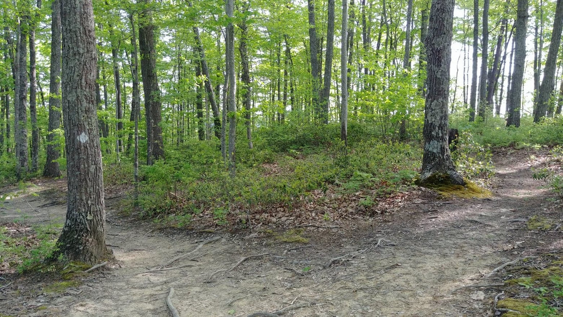 Now, on to some more amazing views! These next few pictures are from the ridge itself. Please be safe and stay away from the edges. Yes, we have a wonderful Search & Rescue crew that does a great job, but let's do our part and not keep them busy. Aren't these views just beautiful?! I could sit up here all day. So I did! Well, not all day. Long enough to drink some water and eat a protein bar while enjoying the hefty breeze, listening to the birds and watching to see if I could see anyone across the way, over at Double Arch. But the trail didn't end here! 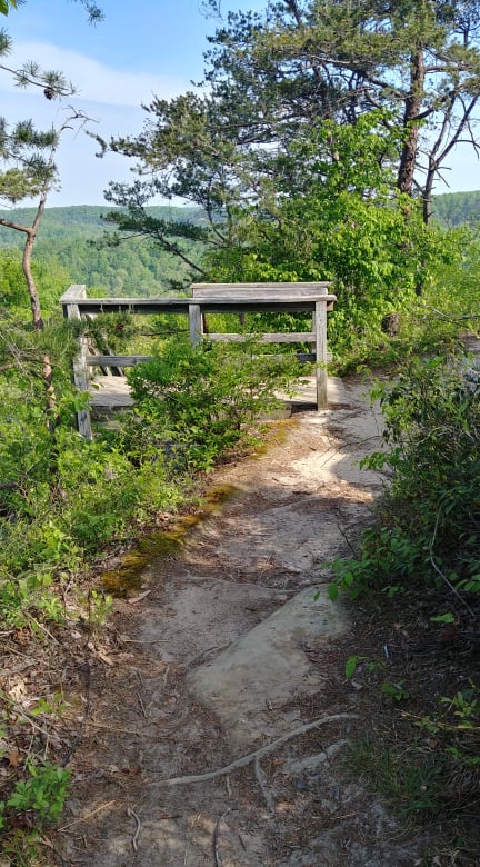 This is usually a site I don't love to see....stairs. But at least I am going down them! And the next few pics are views from those 113 steps! At this point the trail ends at Courthouse Rock. You can either go back or choose to make a turn there and either go on the Courthouse Trail or Double Arch Trail. I chose Courthouse Trail because I have never been on it. But I will share more on that in another post.
Well y'all, I sure hope you enjoyed the pictures and I hope you can get out soon to hike this path. Be safe! Grab that camera and go have fun! And remember... 'Of all the paths you take in life, make sure a few of them are dirt.' - John Muir 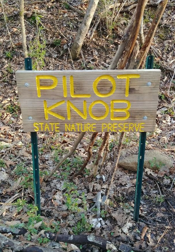 Pilot Knob is a trail that I hike at least once a year. The view is absolutely stunning and definitely a must in the fall! If you are a history buff, it is believed that Daniel Boone stood on this rock and looked out at our beautiful Bluegrass scenery here in Powell County. I will warn you, though...this trail is hard. Not because of crazy knee killer steps or dangerous rock climbing. But simply because the entire trail to the lookout is uphill. When I ask my family if they want to go with me, no matter the season or weather, the answer is always a very firm...NO WAY! So this time I decided to bring Ranger, the puppy dog. Seeing that he crashed without moving for 4 hours after we got home, I'm pretty sure the next time I go, he will run the other way and bark a big NO WAY, too. 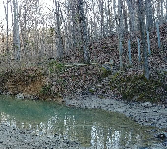 If you are not familiar with the location, take exit 16 off the Mountain Parkway and follow KY 15 north, towards Winchester, for 2.7 miles. Turn right on Brush Creek Road and travel 1.5 miles to the end of the road which turns into a gravel parking lot. Once you cross the creek, go thru the fence row/gate pictured above. You will soon come to an area that has a map and a sign-in box which should have brochures that not only tell about Daniel Boone being here but also the history behind the short Millstone Quarry Trail that is there also. 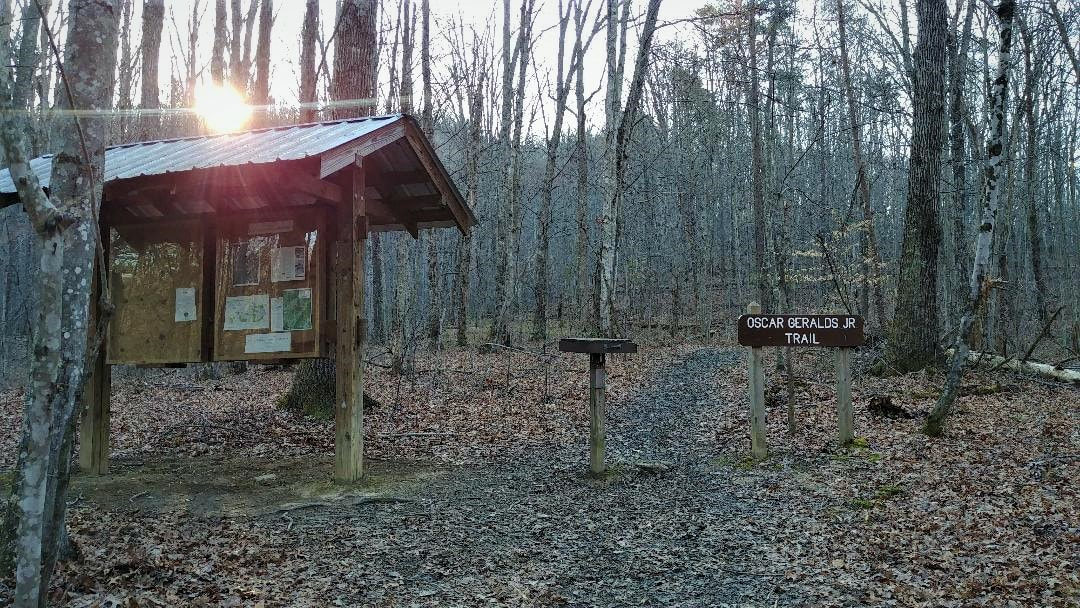 As you start the climb you will notice that the trail is very well maintained and the signage is great. But I did see rebar sticking up in a few places. Usually where there used to be a step. So be careful not to trip! You will notice about half way up, the trail turns from dirt to little pebbles. The very first time I hiked this, years ago, I wondered why in the world people hauled gravel up here?? Well, as I kept going I noticed that the huge boulders were not the normal solid rock boulders. When you look closer, you will see that they are made up of these small pebbles. Also known as Pennsylvania sandstone. From what I read, this is a treat for geology buffs. By now, though, I am huffing and puffing and taking quite a few breaks looking at the wildflowers and today, watching the two deer Ranger and I scared up. 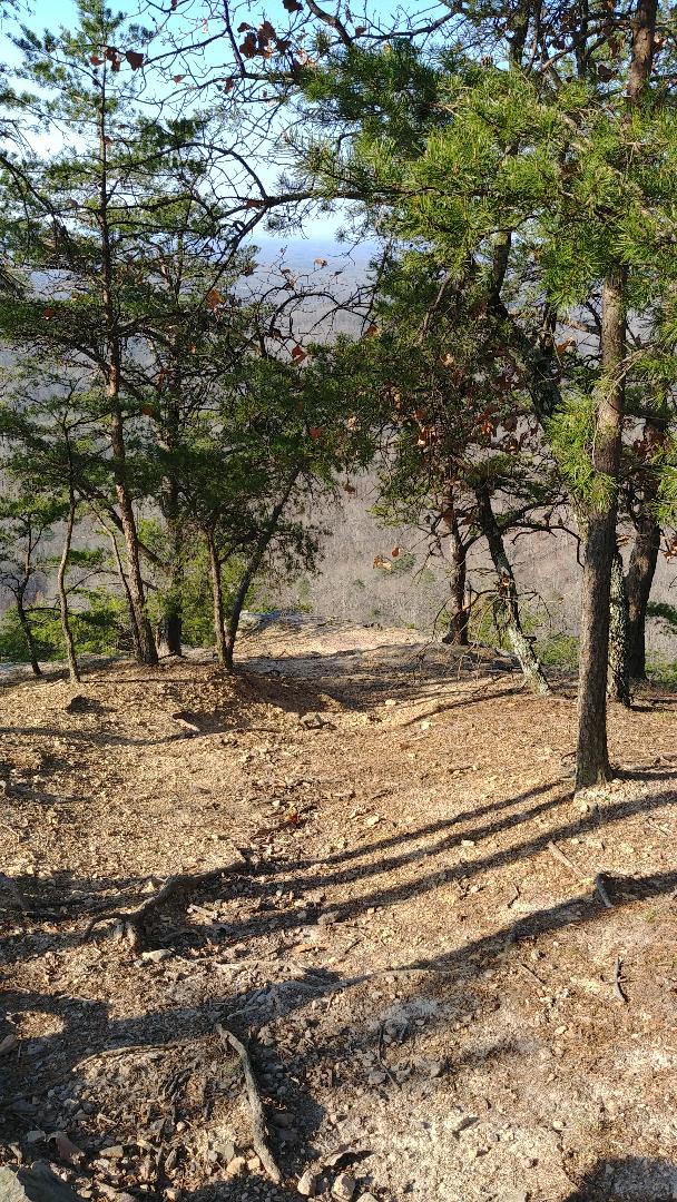 As I am rounding a curve in the trail and obviously gaining altitude, the wind picks up and I know that I am getting close to an amazing view. You can make a stop at an overlook that is just a small distance from the main spot only to give you a small taste of what you are about to see. Or you can walk right on by and get to the main attraction. Get ready for a view not everyone gets to see! 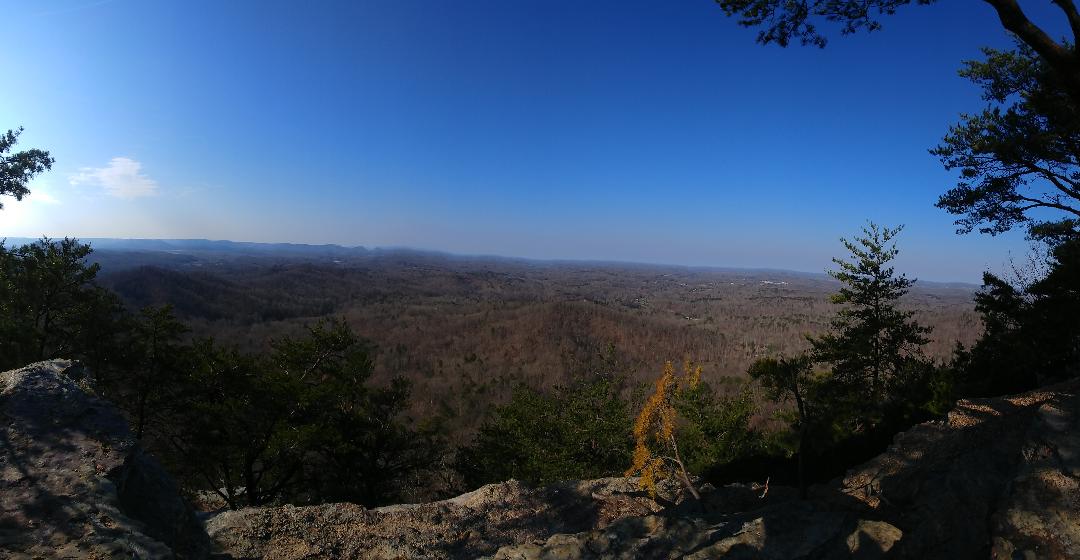 The picture above was supposed a 360 panoramic view, but it is only allowing me to show it as a regular pano pic. Bummer!
Well, you know what this means? You just have to get out and take this hike so you can see exactly why I love this trail and this view! I always take a snack and water and sit right down and try to see as far as I can see...watch the birds fly right in front of me...take lots of pictures and just enjoy the peace and quiet. Trust me...you will be glad you went. The view it totally worth it. So don't forget your camera and snacks and take this hike! The weather is awesome! And remember... 'Of all the paths you take in life, make sure a few of them are dirt.' - John Muir I was really wanting to get outdoors and breathe in the crisp, morning air but could not decide on which trail to hike. I had about 3 hours open in my schedule so I knew I could go on a decent, cardio filled walk. After looking at the maps and wanting to make sure I would stay within my time-frame, I chose to do the DB Hut trail. It is actually one of my favorites. I guess maybe because this was the very first trail we hiked when we moved to Kentucky 12 years ago?? Or maybe because it runs beside a stream for quite awhile so I get to hear its lovely, relaxing sound?? Which, by the way, is wonderful when you have kiddos with you! During the hot summer days they can easily play in it and cool off. Also, the doggies can take a dip and have all the water they need. But it is a well- worn path so I'm thinking I am not the only one that really enjoys it. 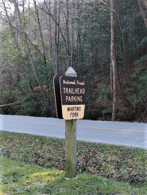 I always get to this trail by parking at the Martin's Fork parking lot. Once you cross the road, you will see this lovely little stream I am talking about.  It can get muddy in areas, so put those hiking boots to good use. But thanks to the US Forest Service-Daniel Boone National Forest Forestry Tech, Charlie Rowe, we have wonderfully built bridges that not only provide a dry path for us, but also look pretty amazing. I did lose count of how many I crossed on this trail, but seriously, who cares. Bridges are fun! This is actually Rough Trail which takes you to the trail-head of the Daniel Boone Hut trail. When you reach this point, it takes a pretty drastic change and can be very difficult in places. Needing to duck/squat under a log...shimmy down narrow parts...big knee bend steps...just to name a few. 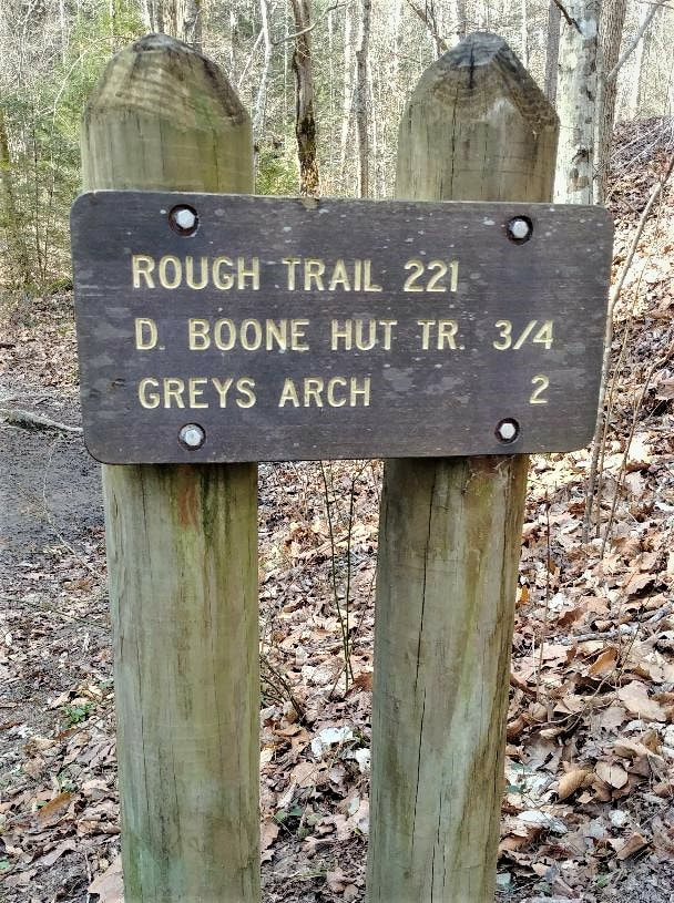 But the end is worth it! And during the rainy season you will even get to enjoy a waterfall! So hopefully you will be able to enjoy this lovely, spring weather and get out to hike! Get that camera ready, have fun and be safe!
Remember... 'Of all the paths you take in life, make sure a few of them are dirt.' - John Muir |
AuthorAngie Gable 
Archives
February 2021
Categories
|
 RSS Feed
Home | Tradio | Contact | Service Portal | Employment (EEO) | Better Radio Reception
[email protected] - Office: Stanton or Irvine (606) 663-2811 - Fax: (606) 663-2895 - Text: (606) 663-2811
All Rights Reserved Moore Country 104, LLC 2009, 2011, 2014, 2020
..::Login::..
We use third-party advertising companies to serve ads when you visit our Website. These companies may use information (not including your name, address email address or telephone number) about your visits to this and other Web sites in order to provide advertisements about goods and services of interest to you. If you would like more information about this practice and to know your choices about not having this information used by these companies, click here.